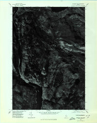
1975 Map of Bingham NW
USGS Topo · Published 1980About this map
Kennebec River corridor defines the western edge of this Somerset County landscape, providing a clear view of the waterway as it appeared in the mid-1970s. This orthophotoquad, derived from aerial photography taken in October 1975, offers a photographic record of the region's dense forest cover and high-elevation terrain. The elevation rises sharply toward the east, where several prominent peaks dominate the horizon, including Moxie Mountain, the Cow Mountain ridge, and the distinct point known as Nubble. To the north, the waters of Pleasant Pond are visible, feeding into the drainage network that includes Austin Stream. This imagery captures a moment of quiet transition in the Maine woods, documenting the timberlands and natural hydrology before decades of subsequent logging and development changed the forest canopy and local access roads.
Find a feature on this map
6 named features on this map. Tap any name to fly to it.
Don’t see what you’re looking for? This feature index may not catch every label — zoom into the map to look around manually.
Map Details
Editions of this 1975 Bingham NW Map
This is the sole edition of this map. No revisions or reprints were ever made.
Other maps of this area

1903 · Bingham
USGS Topo · 1:62,500

1905 · Bingham
USGS Topo · 1:62,500

1905 · The Forks
USGS Topo · 1:62,500

1907 · The Forks
USGS Topo · 1:62,500

1925 · Pierce Pond
USGS Topo · 1:48,000

1927 · Pierce Pond
USGS Topo · 1:62,500

1928 · Dead River
USGS Topo · 1:62,500

1931 · Dead River
USGS Topo · 1:48,000

1944 · Dead River
USGS Topo · 1:62,500

1944 · Pierce Pond
USGS Topo · 1:62,500