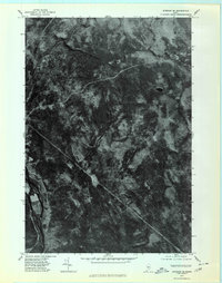
1975 Map of Bingham SE
USGS Topo · Published 1980About this map
The Kennebec River flows through the southwestern corner of this Somerset County landscape, which is defined by a dense network of upland drainage and timberland. This 1975 orthophotoquad provides an unvarnished aerial view of the region's topography, where Austin Stream and Gulf Stream carve through the north, and Withee Pond sits isolated in the northeast. The imagery clearly delineates the clearings and forest access routes that connect elevated landmarks like Mahoney Hill and Johnson Mountain. Unlike traditional topographic maps, this photographic study reveals the actual texture of the ground cover and the specific patterns of land use along Johnson Brook and Mahoney Brook during the mid-1970s, making it a valuable tool for understanding the physical state of the Maine woods before modern developments.
Find a feature on this map
9 named features on this map. Tap any name to fly to it.
Don’t see what you’re looking for? This feature index may not catch every label — zoom into the map to look around manually.
Map Details
Editions of this 1975 Bingham SE Map
This is the sole edition of this map. No revisions or reprints were ever made.
Other maps of this area

1903 · Bingham
USGS Topo · 1:62,500

1904 · Anson
USGS Topo · 1:62,500

1905 · Bingham
USGS Topo · 1:62,500

1913 · Skowhegan
USGS Topo · 1:62,500

1948 · Bangor
USGS Topo · 1:250,000

1948 · Kingsbury
USGS Topo · 1:62,500

1950 · Kingsbury
USGS Topo · 1:62,500

1954 · Millinocket
USGS Topo · 1:250,000

1955 · Anson
USGS Topo · 1:62,500

1955 · Skowhegan
USGS Topo · 1:62,500