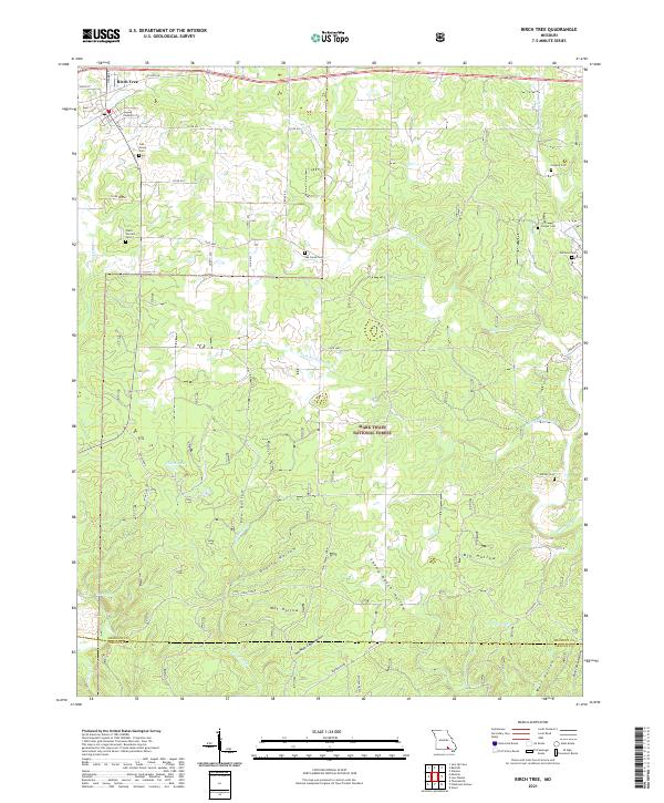
2021 Map of Birch Tree
USGS Topo · Published 2021About this map
The town of Birch Tree serves as a northern anchor for this landscape, where the Missouri Ozarks transition into the dense woods of the Mark Twain National Forest. A high concentration of family and community burial grounds, including Lindsey Cem, Oak Grove Cem, and Warm Corners Cem, suggests a long-standing pattern of rural settlement along the ridges and creek valleys. The terrain is deeply dissected by a network of drainage systems such as Hurricane Cr and Bee Fork Cr, which feed into numerous named hollows. These secluded valleys, like Wet Hollow, Grassy Hollow, and the industrially named Mine Hollow, reflect the traditional timber and agricultural use of the land. Water features are frequent but localized, ranging from small cattle or farm impoundments like Fisher Pond and Elbow Pond to natural sources like Cave Spring and Spring Cr near the Oregon County line.
Find a feature on this map
50 named features on this map. Tap any name to fly to it.
Don’t see what you’re looking for? This feature index may not catch every label — zoom into the map to look around manually.
Map Details
Editions of this 2021 Birch Tree Map
This is the sole edition of this map. No revisions or reprints were ever made.
Other maps of this area

1915 · Eminence
USGS Topo · 1:62,500

1917 · Eminence
USGS Topo · 1:62,500

1931 · Bandyville
USGS Topo · 1:48,000

1944 · Birch Tree
USGS Topo · 1:62,500

1945 · Montier
USGS Topo · 1:62,500

1946 · Summersville
USGS Topo · 1:62,500

1948 · Montier
USGS Topo · 1:62,500

1948 · Birch Tree
USGS Topo · 1:62,500

1948 · Summersville
USGS Topo · 1:62,500

1949 · Rolla
USGS Topo · 1:250,000