Old Maps of Oregon County, Missouri
Explore 181 old maps of Oregon County, spanning from 1931 to today. These high-resolution historic maps reveal how streets, neighborhoods, landmarks, and natural features evolved over time — perfect for genealogy, metal detecting, research, and local history exploration.
What you can do with these maps:
- See how Oregon County changed over time: Compare historical maps to modern-day views to trace roads, homesites, rail lines & more.
- View detailed metadata: Each map includes creators, publishers, year, scale, and archive source.
- Overlay maps with satellite & LiDAR: Visualize the past alongside modern tools to explore terrain & human change.
- Trusted historical sources: Maps sourced from the USGS, Library of Congress, and other archives.
- Access maps your way: View online, download high-res files, or order prints for personal or research use.
Start exploring old maps of Oregon County to uncover forgotten places, hidden landmarks, and the deep history beneath your feet.
Oregon County, MO maps
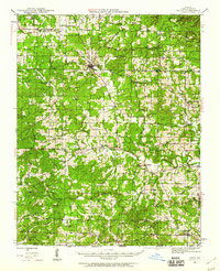
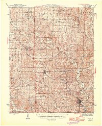
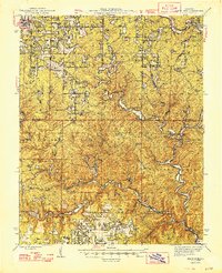
(181)- 1931 Map of Bandyville
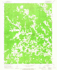
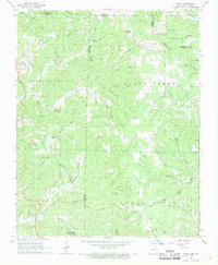
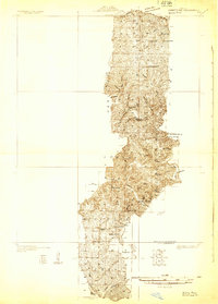 1931 Bandyville1931 Print · USGSThe Eleven Point River valley in the early 1930s remains a landscape of isolated rural townships and crossroads schools. Genealogists can trace family roots through sites like Falling Springs Cemetery, Hickory Grove Ch, and Bildad Sch.
 - 1941 Map of Gatewood
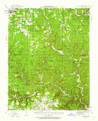
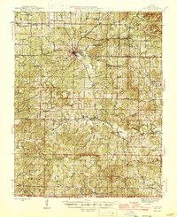
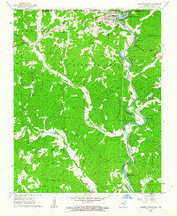
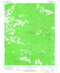
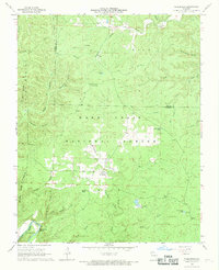
 1941 Gatewood1941 Print · USGSThe Missouri Ozarks meet the Arkansas border in the 1930s, a period when the Eleven Point River was the lifeblood of remote forest communities. Researchers can locate dozens of country schoolhouses like Charter Oak Sch and river landmarks such as Stubblefield Ferry.
 - 1943 Map of Thayer, 1963 Print
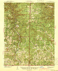
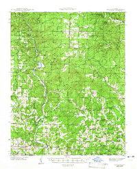
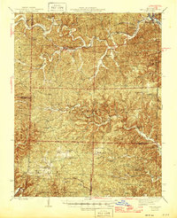
 1943 Thayer1963 Print · USGSThayer and Koshkonong sit at the heart of the Ozark borderlands during the early 1940s, as the railroad drove local commerce. Researchers can locate dozens of country schools and family landmarks like Grand Gulf, Harbeston Sink, and Victory Mission Ch.2 unique versions available
 - 1944 Map of Van Buren, 1960 Print
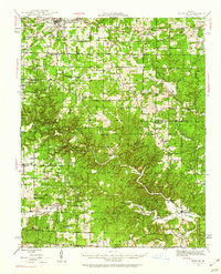
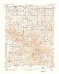
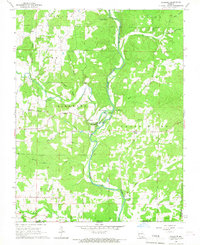
 1944 Van Buren1960 Print · USGSThe Ozark hill country of Carter and Shannon counties appears here in the mid-1940s. Researchers can trace the St Louis San Francisco rail line or locate rural sites like Pleasant Site Cem, Chicopee, and the Bristoll Sch.2 unique versions available
 - 1944 Map of Couch, 1960 Print
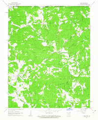
 1944 Couch1960 Print · USGSThe Missouri Ozarks and the Arkansas borderlands appear in mid-century detail during the 1940s, highlighting the remote settlement of Oregon County. Genealogists can trace family footprints through numerous rural landmarks like Smyrna Ch, Couch Sch, and Hollis Cem.2 unique versions available
 - 1944 Map of Birch Tree, 1962 Print
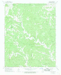
 1944 Birch Tree1962 Print · USGSShannon and Oregon Counties are shown in the mid-1940s, a landscape defined by the winding Eleven Point River and isolated Ozark settlements. Genealogists and historians can trace family roots through sites like Oak Forest Cem, Fair Grove Sch, and New Liberty.2 unique versions available
 - 1945 Map of Gatewood
 1945 Gatewood1945 Print · USGSRipley and Oregon counties are shown during the 1930s and 40s, a period defined by the growth of the national forest and river-based commerce. Genealogists can locate family landmarks like Stubblefield Ferry, Thomasons Mill, and schools such as Mt Carmel Sch.3 unique versions available
 - 1945 Map of Montier, 1960 Print
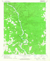
 1945 Montier1960 Print · USGSThe Missouri Ozarks during the mid-1940s are documented here, showing a landscape of small settlements and river valleys just as the post-war era began. Local historians can trace dozens of country schools and churches, from Gravel Ridge Sch to the Hilltop Mission and the remote Sherwood Reese Ranch.2 unique versions available
 - 1946 Map of Thayer
 1946 Thayer1946 Print · USGSOregon and Howell Counties in the 1940s reveal a network of rail-dependent towns and rural school districts along the Arkansas line. Genealogists can trace family roots through numerous sites like Woodside Cem, Victory Mission Ch, and the many community schools like English Sch.2 unique versions available
 - 1946 Map of Couch
 1946 Couch1946 Print · USGSOregon County is captured mid-century near the Arkansas border as the rural community network of one-room schools and country churches remained intact. Genealogists can locate family landmarks like Hollow Cem, Nebo Sch, and the settlements of Couch and Myrtle.2 unique versions available
 - 1946 Map of Van Buren
 1946 Van Buren1946 Print · USGSThe Ozark foothills of Carter County are shown here in the 1940s, dominated by the winding Current River and the sprawling Clark National Forest. Genealogists and hikers can trace the footprints of rural communities at Wilderness, Bristol Church, and Rinnard School.2 unique versions available
 - 1948 Map of Montier
 1948 Montier1948 Print · USGSPost-war Howell, Shannon, and Oregon Counties come to life here, showing the ridge-and-hollow social network of the Missouri Ozarks. Genealogists can trace family names through dozens of rural landmarks like Marble Hill Sch, Bennett Chapel, and the Brown Cem.2 unique versions available
 - 1948 Map of Birch Tree
 1948 Birch Tree1948 Print · USGSThe Missouri Ozarks are documented here in the late 1940s, showing a landscape of state forests and spring-fed rivers. Local historians can trace family locations near New Liberty, Oak Forest Cem, and numerous rural schoolhouses like Spring Creek Sch.2 unique versions available
 - 1957 Map of Poplar Bluff, 1968 Print
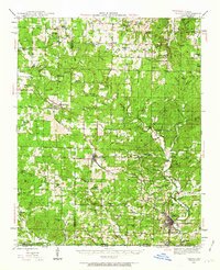
 1957 Poplar Bluff1968 Print · USGSThe Missouri-Arkansas border region is captured here as the timber and rail industries shaped the Ozark foothills. Genealogists and historians can trace the Missouri Pacific Railroad through river towns like Pocahontas, Greenville, and Van Buren.3 unique versions available
 - 1959 Map of Poplar Bluff
 1959 Poplar Bluff1959 Print · USGSThe Missouri Ozarks and Arkansas borderlands meet in this late 1950s study of the region's diverse terrain and rail-fed towns. Researchers can trace the path of the Missouri Pacific Railroad through Poplar Bluff or locate smaller settlements like Birch Tree and Myrtle.
 - 1960 Map of Poplar Bluff
 1960 Poplar Bluff1960 Print · USGSSoutheast Missouri and Northeast Arkansas are captured here during the post-war era, showing the transition from the Ozark highlands to the Delta. Genealogists and historians can trace rail corridors like the St. Louis Southwestern RR and remote settlements such as Birch Tree and Warm Springs.
 - 1962 Map of Mammoth Spring, 1963 Print
 1962 Mammoth Spring1963 Print · USGSThe Missouri-Arkansas borderlands come alive in the early sixties as the St Louis San Francisco railroad follows the winding Spring River. Trace family history at McLemore Cem, visit Dewey Sch, or explore the springs and hollows near Many Islands.
 - 1962 Map of Camp, 1963 Print
 1962 Camp1963 Print · USGSThe Arkansas-Missouri borderlands come to life in the early sixties, showing a landscape of upland springs and winding creek beds. Researchers can trace rural lineages through Fryatt, Pleasant Valley Ch, and family landmarks like Kerby Cem.2 unique versions available
 - 1965 Map of Riverton, 1967 Print
 1965 Riverton1967 Print · USGSThe Eleven Point River valley in the mid-1960s remains a landscape of deep hollows and cold springs within the Mark Twain National Forest. Genealogists and historians can locate rural landmarks like Whitten Ch, Boze Mill Spr, and the Windy Lookout Tower.2 unique versions available
 - 1965 Map of Gatewood, 1967 Print
 1965 Gatewood1967 Print · USGSThe Missouri-Arkansas borderlands come to life in the mid-1960s, showing a landscape of forest lookouts and winding creek forks. Researchers can trace rural lineages through the Gatewood community and find old country landmarks like Johnson Chapel and the Mulvinia Lookout Tower.
 - 1965 Map of Bardley, 1967 Print
 1965 Bardley1967 Print · USGSThe Ozark woodlands of Oregon and Ripley County are captured here in the mid-1960s, showing a landscape defined by forestry and deep-cut creek hollows. Researchers can locate remote community landmarks like Pine Sch, Oak Ridge Ch, and the Briar Lookout Tower.2 unique versions available
 - 1966 Map of Billmore, 1967 Print
 1966 Billmore1967 Print · USGSThe Eleven Point River valley in the mid-1960s was a landscape of remote farmsteads and natural springs. You can trace early local history at Billmore and Calm, or locate legacy landmarks like Liberty Church and the distinctive Narrows.2 unique versions available
 - 1968 Map of Hardy NE, 1969 Print
 1968 Hardy NE1969 Print · USGSRandolph County, Arkansas, and the Missouri state line meet in this late 1960s survey of the Ozark foothills. Researchers can trace family history through numerous rural burial sites like James Cem and Davis Cem or locate community centers like English Bluff Ch.2 unique versions available
 - 1968 Map of Wirth, 1969 Print
 1968 Wirth1969 Print · USGSThe borderlands of Sharp and Fulton County come to life in the late 1960s, showing a rural landscape of winding hollows and small family settlements. Genealogists can locate several remote burial grounds and churches, including Ed Collins Cemetery, Bethel Cemetery, and Union Hill Church.2 unique versions available
 - 1968 Map of Wilderness, 1969 Print
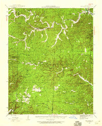
 1968 Wilderness1969 Print · USGSThe Oregon County backcountry in the late sixties reveals a landscape of forestry and secluded hollows within the Mark Twain National Forest. Trace family roots near Wilderness or locate landmarks like Freeman Cem, Falling Spring, and the Sinking Creek Lookout Tower.2 unique versions available
Showing maps 1-25 of 181
Top cities of Oregon County
Frequently asked questions
- What are the different types of historical maps available for Oregon County?
- What is the oldest map of Oregon County?
- Where can I purchase historical maps of Oregon County for my home or office?
- Where can I download high-res historical maps of Oregon County?
- Are there historical topographic maps available for Oregon County?
- Is there historical aerial imagery available for Oregon County?
- Where are historical maps of Oregon County sourced from?