1980s Maps of Oregon County, Missouri
Explore 20 historic maps of Oregon County from the 1980s. These maps offer a rare glimpse into what life looked like during the 1980s — showing old roads, neighborhoods, homes, and landmarks that have changed or disappeared over time.
Whether you're researching your family's past, planning a metal detecting trip, or studying how Oregon County's landscape evolved across the 1980s, these high-resolution maps are a powerful tool for exploring the history of this region.
- Focus on a specific era: All maps on this page are from the 1980s, giving you a focused view of this time period.
- See what’s changed: Compare century-old streets, trails, and buildings to today's modern landscape using overlays and satellite layers.
- Research with precision: Use these maps for genealogy, historical research, land use analysis, or educational projects.
- View, download, or print: Maps are fully viewable online in high resolution, and can be downloaded or printed for your own records.
Start exploring Oregon County's history through authentic maps from the 1980s. This is your window into the past.
Oregon County, MO maps
(20)- 1982 Map of Birch Tree
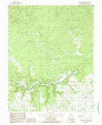
 1982 Birch Tree1982 Print · USGSBirch Tree and the surrounding Ozark woodlands are captured here in the early 1980s, straddling the Shannon and Oregon County border. Genealogists and local historians can trace rural landmarks like Cave Spring, the Mine near Fisher Pond, and several local cemeteries.
 - 1982 Map of Couch, 1983 Print
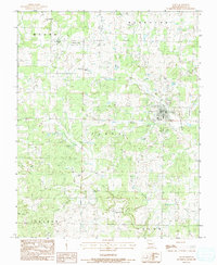
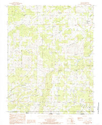
 1982 Couch1983 Print · USGSOregon County, Missouri, is captured in the early 1980s as a landscape of deep hollows and rural congregations along the Arkansas border. Genealogists and local historians can trace family locations near Couch, Drytown Ch, and the remote Jeff settlement.
 - 1982 Map of Piedmont Hollow, 1983 Print
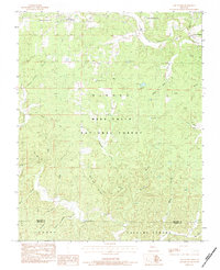
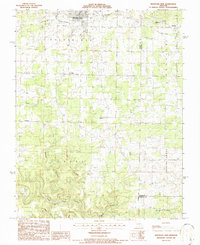
 1982 Piedmont Hollow1983 Print · USGSThe Eleven Point River corridor in the early eighties shows a landscape defined by deep-cut hollows and protected timberlands. Genealogists can trace family roots at Spring Creek Cem and locate landmarks like Roaring Spring or the Church of Christ.
 - 1983 Map of Cherokee Village
 1983 Cherokee Village1983 Print · USGSThe Ozark foothills and river valleys of Northeast Arkansas are captured in the early eighties as modern planned communities began to reshape the landscape. Genealogists and historians can trace family-named ridges and schools across Evening Shade, Melbourne, and the rail junction at Hoxie.
 - 1983 Map of Greer, 1984 Print
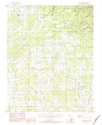
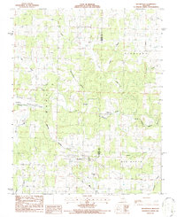
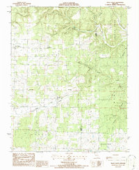
 1983 Greer1984 Print · USGSOregon County in the early 1980s reveals a landscape of springs and deep hollows along the Eleven Point National Scenic River. Genealogists and local historians can trace family-named sites like Hall Cem, Carters Shop Hollow, and Thomasville.
 - 1983 Map of Low Wassie, 1984 Print
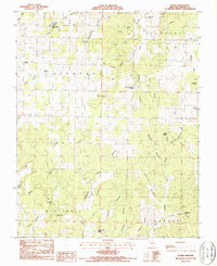
 1983 Low Wassie1984 Print · USGSThe Missouri Ozarks near Winona and Low Wassie come into focus during the early 1980s, showcasing a landscape defined by timber and transport. Trace local history along the Old Pike Railroad Grade and locate family landmarks like Mt Zion Cem.
 - 1983 Map of Alton, 1984 Print
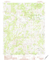
 1983 Alton1984 Print · USGSOregon County in the early eighties shows a landscape of deep hollows and rural community centers. Researchers can locate family heritage sites like Huddleston Chapel, Shiloh Ch, and the Royal Oak Cem near the town of Alton.
 - 1983 Map of Many Springs, 1984 Print
 1983 Many Springs1984 Print · USGSOregon County is captured in the early eighties as a landscape of rural congregations and deep Ozark hollows. Genealogists and local historians can locate several family landmarks, from Bailey Chapel and Nebo Ch to the Hollfs Cem.
 - 1984 Map of Myrtle
 1984 Myrtle1984 Print · USGSOregon County, Missouri, at the edge of the Arkansas border in the 1980s shows a landscape of tight-knit rural communities and spring-fed creeks. Researchers can trace family roots through sites like Jobe Cemetery, Couch Schools, and the First Baptist Church in Myrtle.
 - 1984 Map of West Plains
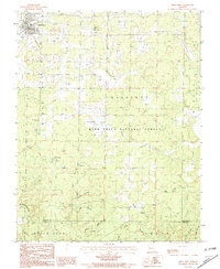
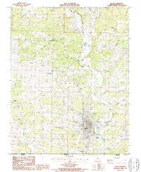
 1984 West Plains1984 Print · USGSThe Missouri Ozarks are mapped here in the mid-1980s, centered on the regional hub of West Plains and the river corridors of the Eleven Point River. Trace the old rail lines and timber towns of Willow Springs, Mountain View, and Birch Tree through the Mark Twain National Forest.2 unique versions available
 - 1984 Map of Piedmont Hollow, 1985 Print
 1984 Piedmont Hollow1985 Print · USGSThe Eleven Point River valley in the early eighties was a landscape of deep timber and hidden springs within the Mark Twain National Forest. Genealogists and local historians can locate remote burial sites like Spring Creek Cem and Hickory Grove Cem near Cane Bluff.
 - 1984 Map of Couch, 1985 Print
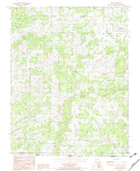
 1984 Couch1985 Print · USGSOregon County during the mid-eighties shows a deeply carved landscape of hollows and ridges along the Missouri-Arkansas border. Genealogists can trace family footprints through numerous rural landmarks like Norman Ch, Eldorado Spring, and the high ground of Watered Ridge.
 - 1986 Map of Mountain View
 1986 Mountain View1986 Print · USGSMountain View and its rural surroundings are captured in the mid-1980s at the meeting point of Howell, Shannon, and Oregon counties. Genealogists and local historians can locate Gravel Ridge Ch, the Old Railroad Grade, and the Eleven Point River headwaters.
 - 1986 Map of Brandsville
 1986 Brandsville1986 Print · USGSThe Missouri Ozarks are captured in the mid-1980s, centered on the railroad town of Brandsville and its rugged creek valleys. Genealogists and researchers can trace the tracks of the Burlington Northern and find rural landmarks like Pocohontas Crossing and Harbeston Sink.
 - 1986 Map of Thayer
 1986 Thayer1986 Print · USGSThe Missouri-Arkansas border comes alive in the mid-1980s, centered on the historic rail town of Thayer. Researchers can trace old neighborhood lines in Old Town and Green Town or locate family roots near Childress Cem and Shelby.
 - 1986 Map of Montier
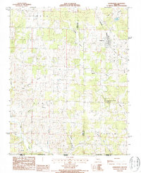
 1986 Montier1986 Print · USGSShannon and Oregon Counties in the mid-1980s reveal a landscape of rural congregations and former rail lines. Researchers can trace the Old Railroad Grade past the Abd Mine and locate historic meeting places like Bethlehem Ch or Corinth Ch.
 - 1986 Map of Koshkonong
 1986 Koshkonong1986 Print · USGSThe Missouri Ozarks meet the Arkansas border in the mid-1980s, where rail-line settlements and deep-cut hollows define the rural landscape. Trace the tracks of the Burlington Northern through Koshkonong or explore the karst features near Grand Gulf State Park.
 - 1986 Map of Thomasville, 1987 Print
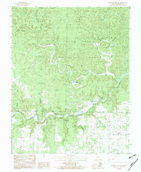
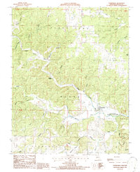 1986 Thomasville1987 Print · USGSThomasville and the Eleven Point River valley are documented here in the mid-1980s. Local historians can trace the landscape around the Iron Mine (Inactive), local burials at the Cem, and natural landmarks like Bill Mac Spring.
 - 1986 Map of Peace Valley, 1987 Print
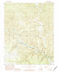
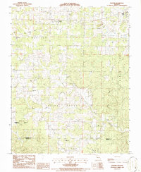
 1986 Peace Valley1987 Print · USGSOzark plateau life near the Howell and Oregon county line is documented here in the mid-1980s. Genealogists can trace local landmarks like Pilgrims Rest Ch, the settlement of Fanchon, and industrial markers such as Kilns near Peace Valley.
 - 1986 Map of Rover, 1990 Print
 1986 Rover1990 Print · USGSOregon County in the mid-eighties shows a rural landscape of spring-fed hollows and traditional river crossings. Genealogists and local historians can trace old family sites near Redburn Cem, Elliott Ford, and the namesake settlement of Rover.
End of results
Showing maps 1-20 of 20
Top cities of Oregon County
Frequently asked questions
- What are the different types of historical maps available for Oregon County?
- What is the oldest map of Oregon County?
- Where can I purchase historical maps of Oregon County for my home or office?
- Where can I download high-res historical maps of Oregon County?
- Are there historical topographic maps available for Oregon County?
- Is there historical aerial imagery available for Oregon County?
- Where are historical maps of Oregon County sourced from?