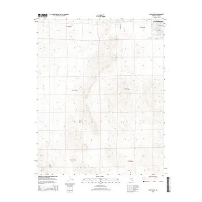
2014 Map of Bird Spring
USGS Topo · Published 2014About this map
Enterprise sits at the northeastern edge of this Clark County landscape, where the early 21st-century residential grid begins to push into the open Mojave Desert. The map captures a distinct boundary between the formal street names of a growing community—including W Cactus Ave, S Buffalo Dr, and Pepperbox Ave—and the high, undeveloped terrain of the Bird Spring Range to the southwest. This contrast illustrates the rapid expansion of the Las Vegas valley periphery during the 2010s. Beyond the suburban edge, the topography rises sharply toward Bird Spring, revealing the natural drainage patterns and elevation changes that dictated the limits of early development. The inclusion of Public Land Survey System township and range lines, such as t23s r59e, provides an essential framework for researchers tracing property boundaries and land use at the urban-desert interface.
Find a feature on this map
16 named features on this map. Tap any name to fly to it.
Don’t see what you’re looking for? This feature index may not catch every label — zoom into the map to look around manually.
Map Details
Editions of this 2014 Bird Spring Map
This is the sole edition of this map. No revisions or reprints were ever made.
Other maps of this area

1907 · Las Vegas
USGS Topo · 1:250,000

1908 · Las Vegas
USGS Topo · 1:250,000

1910 · Ivanpah
USGS Topo · 1:250,000

1912 · Ivanpah
USGS Topo · 1:250,000

1942 · Ivanpah
USGS Topo · 1:250,000

1947 · Kingman
USGS Topo · 1:250,000

1948 · Kingman
USGS Topo · 1:250,000

1952 · Blue Diamond
USGS Topo · 1:62,500

1952 · Las Vegas
USGS Topo · 1:62,500

1954 · Las Vegas
USGS Topo · 1:250,000