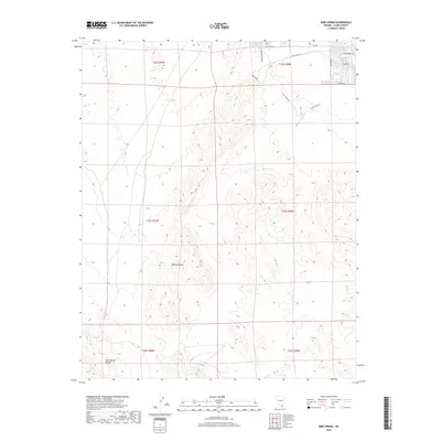
2018 Map of Bird Spring
USGS Topo · Published 2018About this map
Bird Spring Range rises from the arid basin in this corner of the Mojave Desert south of Las Vegas. The landscape reveals the tension between the expanding suburban grid of Clark County and the persistent industrial utility of the high desert. To the northeast, residential street developments including W Cactus Ave and S Buffalo Dr push right against the working landscape of the Alden Quarries. These expansive excavations are a significant feature of the local topography, marking where the desert is literally being shaped to fuel the region's growth. Toward the southwest, the terrain becomes increasingly complex as the alluvial fans give way to the more prominent elevations of the range, centered around the eponymous Bird Spring.
Find a feature on this map
17 named features on this map. Tap any name to fly to it.
Don’t see what you’re looking for? This feature index may not catch every label — zoom into the map to look around manually.
Map Details
Editions of this 2018 Bird Spring Map
This is the sole edition of this map. No revisions or reprints were ever made.
Other maps of this area

1907 · Las Vegas
USGS Topo · 1:250,000

1908 · Las Vegas
USGS Topo · 1:250,000

1910 · Ivanpah
USGS Topo · 1:250,000

1912 · Ivanpah
USGS Topo · 1:250,000

1942 · Ivanpah
USGS Topo · 1:250,000

1947 · Kingman
USGS Topo · 1:250,000

1948 · Kingman
USGS Topo · 1:250,000

1952 · Blue Diamond
USGS Topo · 1:62,500

1952 · Las Vegas
USGS Topo · 1:62,500

1954 · Las Vegas
USGS Topo · 1:250,000