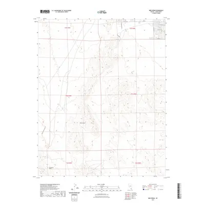
2021 Map of Bird Spring
USGS Topo · Published 2021About this map
The Bird Spring Range dominates this portion of the Mojave Desert in southern Nevada, showcasing the arid topography south of the Las Vegas valley as it appeared in 2021. The map documents a sharp transition between the undeveloped mountain slopes and the advancing suburban grid of Clark County. In the northeast corner, a network of residential streets including W Cactus Ave and S Buffalo Dr marks the edge of urban expansion, while the rest of the landscape remains defined by alluvial fans and desert washes. A notable path for recreation and history is the Blue Diamond To Jean Trl, which traverses the western foothills near Bird Spring. This map is particularly useful for tracking the modern encroachment of the city into the surrounding desert wilderness.
Find a feature on this map
18 named features on this map. Tap any name to fly to it.
Don’t see what you’re looking for? This feature index may not catch every label — zoom into the map to look around manually.
Map Details
Editions of this 2021 Bird Spring Map
This is the sole edition of this map. No revisions or reprints were ever made.
Other maps of this area

1907 · Las Vegas
USGS Topo · 1:250,000

1908 · Las Vegas
USGS Topo · 1:250,000

1910 · Ivanpah
USGS Topo · 1:250,000

1912 · Ivanpah
USGS Topo · 1:250,000

1942 · Ivanpah
USGS Topo · 1:250,000

1947 · Kingman
USGS Topo · 1:250,000

1948 · Kingman
USGS Topo · 1:250,000

1952 · Blue Diamond
USGS Topo · 1:62,500

1952 · Las Vegas
USGS Topo · 1:62,500

1954 · Las Vegas
USGS Topo · 1:250,000