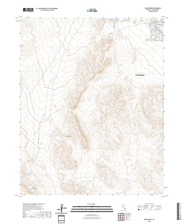
2023 Map of Bird Spring
USGS Topo · Published 2023About this map
Enterprise serves as the primary developed anchor in this southwestern corner of the Las Vegas Valley, where suburban expansion meets the open Mojave Desert. The map documents a sharp transition from the residential street grid in the northeast—defined by corridors like W Cactus Ave and W Starr Ave—to the arid topography of the Bird Spring Range. This southern Nevada landscape is shaped by the desert’s natural drainage patterns, with the namesake Bird Spring situated at the base of the mountains. The presence of the Blue Diamond To Jean Trl highlights the enduring importance of north-south travel routes through the high desert, connecting disparate mountain basins across the rugged Clark County terrain.
Find a feature on this map
20 named features on this map. Tap any name to fly to it.
Don’t see what you’re looking for? This feature index may not catch every label — zoom into the map to look around manually.
Map Details
Editions of this 2023 Bird Spring Map
This is the sole edition of this map. No revisions or reprints were ever made.
Other maps of this area

1907 · Las Vegas
USGS Topo · 1:250,000

1908 · Las Vegas
USGS Topo · 1:250,000

1910 · Ivanpah
USGS Topo · 1:250,000

1912 · Ivanpah
USGS Topo · 1:250,000

1942 · Ivanpah
USGS Topo · 1:250,000

1947 · Kingman
USGS Topo · 1:250,000

1948 · Kingman
USGS Topo · 1:250,000

1952 · Blue Diamond
USGS Topo · 1:62,500

1952 · Las Vegas
USGS Topo · 1:62,500

1954 · Las Vegas
USGS Topo · 1:250,000