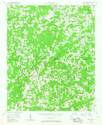
1956 Map of Birmingham
USGS Topo · Published 1968About this map
The agrarian communities of northern Fulton County and southern Cherokee County are shown here in the mid-1950s, a period defined by a decentralized network of country churches and small rural hubs. This area was anchored by crossroads like Birmingham and Lathemtown, where life centered around institutions such as Boiling Spring Ch and Union Hill Sch. The landscape is etched by the Little River and numerous tributaries like Mill Creek and Chicken Creek, which historically dictated the path of local travel and settlement.
Find a feature on this map
36 named features on this map. Tap any name to fly to it.
Don’t see what you’re looking for? This feature index may not catch every label — zoom into the map to look around manually.
Map Details
Editions of this 1956 Birmingham Map
4 editions found
Other maps of this area

1890 · Suwanee
USGS Topo · 1:125,000

1894 · Suwanee
USGS Topo · 1:125,000

1926 · Tate
USGS Topo · 1:62,500

1928 · Tate
USGS Topo · 1:62,500

1955 · Rome
USGS Topo · 1:250,000

1956 · Duluth
USGS Topo · 1:24,000
1956 · Mountain Park
USGS Topo · 1:24,000

1956 · Roswell
USGS Topo · 1:24,000

1956 · Birmingham
USGS Topo · 1:24,000

1958 · Rome
USGS Topo · 1:250,000