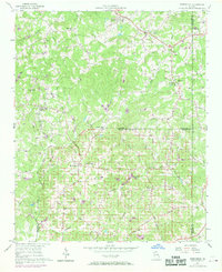
1956 Map of Birmingham
USGS Topo · Published 1969About this map
Birmingham sits at the intersection of rural routes where Cherokee, Forsyth, and Fulton counties meet, anchoring a landscape of scattered family farms and country congregations. This mid-century survey reveals a transition from traditional agricultural life to a more connected rural network. The settlement at Orange and the community around Free Home are defined by their local landmarks, such as Orange Ch and Elbethel Ch, which served as social anchors for the surrounding residents.
Find a feature on this map
44 named features on this map. Tap any name to fly to it.
Don’t see what you’re looking for? This feature index may not catch every label — zoom into the map to look around manually.
Map Details
Editions of this 1956 Birmingham Map
4 editions found
Other maps of this area

1890 · Suwanee
USGS Topo · 1:125,000

1894 · Suwanee
USGS Topo · 1:125,000

1926 · Tate
USGS Topo · 1:62,500

1928 · Tate
USGS Topo · 1:62,500

1955 · Rome
USGS Topo · 1:250,000

1956 · Duluth
USGS Topo · 1:24,000
1956 · Mountain Park
USGS Topo · 1:24,000

1956 · Roswell
USGS Topo · 1:24,000

1956 · Birmingham
USGS Topo · 1:24,000

1958 · Rome
USGS Topo · 1:250,000