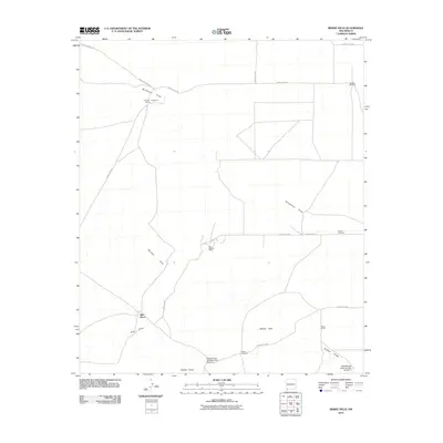
2010 Map of Bisbee Hills
USGS Topo · Published 2010About this map
Burdick Hills and the Bisbee Hills dominate this portion of the southwestern New Mexico landscape, a region defined by ephemeral watercourses and isolated ranching outposts. Settled activity is concentrated at family sites like Stringer Ranch, Ellenwood, and Eller Place, illustrating the sparse, livestock-driven economy of the era. The presence of Big Digging Mines in the center of the quadrangle points to the enduring search for mineral wealth within the arid terrain.
Find a feature on this map
21 named features on this map. Tap any name to fly to it.
Don’t see what you’re looking for? This feature index may not catch every label — zoom into the map to look around manually.
Map Details
Editions of this 2010 Bisbee Hills Map
This is the sole edition of this map. No revisions or reprints were ever made.
Other maps of this area

1899 · Deming
USGS Topo · 1:125,000

1915 · Deming
USGS Topo · 1:125,000

1917 · Hermanas
USGS Topo · 1:62,500

1918 · Hermanas
USGS Topo · 1:62,500

1918 · Victorio
USGS Topo · 1:62,500

1943 · Hermanas
USGS Topo · 1:62,500

1953 · El Paso
USGS Topo · 1:250,000

1954 · Silver City
USGS Topo · 1:250,000

1955 · Douglas
USGS Topo · 1:250,000

1955 · Las Cruces
USGS Topo · 1:250,000