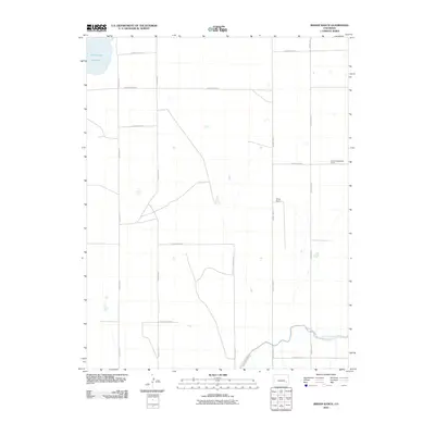
2010 Map of Bishop Ranch
USGS Topo · Published 2010About this map
Bishop Ranch and the Cordes-Oberlander Ranch occupy this high plains landscape in Bent County, where an extensive network of rural roads organizes the agricultural terrain. The map reveals the critical role of water management in this arid environment, dominated by the Fort Lyon Canal in the south and the Adobe Creek Reservoir in the northwest. This 2010 survey illustrates the persistent grid of local infrastructure, from County Road VV in the north to County Road LL in the south. The transition from large ranching properties to the engineered waterways of the Fort Lyon Canal Rd corridor highlights the intersection of traditional land use and twentieth-century irrigation developments.
Find a feature on this map
17 named features on this map. Tap any name to fly to it.
Don’t see what you’re looking for? This feature index may not catch every label — zoom into the map to look around manually.
Map Details
Editions of this 2010 Bishop Ranch Map
This is the sole edition of this map. No revisions or reprints were ever made.
Other maps of this area

1891 · Las Animas
USGS Topo · 1:125,000

1893 · Las Animas
USGS Topo · 1:125,000

1953 · Las Animas
USGS Topo · 1:24,000

1953 · Cornelia
USGS Topo · 1:24,000

1953 · Kreybill
USGS Topo · 1:24,000

1954 · Lamar
USGS Topo · 1:250,000

1955 · Tree Top Ranch
USGS Topo · 1:24,000

1955 · Mc Intosh Ranch
USGS Topo · 1:24,000

1955 · Bishop Ranch
USGS Topo · 1:24,000

1958 · Lamar
USGS Topo · 1:250,000