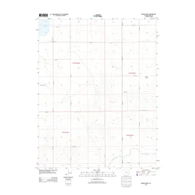
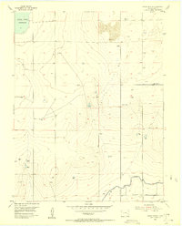
2013 Map of Bishop Ranch
USGS Topo · Published 2013About this map
Agricultural operations and water management systems define this high plains landscape in Bent County. The namesake Bishop Ranch and Cordes-Oberlander Ranch stand out as primary centers of activity within a vast grid of county roads, including CO Road RR 5/10 and CO Hwy-14. These named ranches reflect the enduring cattle and farming legacy of the region, where large landholdings are a necessity of the arid environment. Water infrastructure is critical to the survival of these operations, as evidenced by the Adobe Cr Reservoir in the northwest and the Fort Lyon Canal cutting across the southern portion of the sheet. The canal, a significant piece of engineering, illustrates how diverted water has historically supported agricultural production in this part of Colorado.
Find a feature on this map
22 named features on this map. Tap any name to fly to it.
Don’t see what you’re looking for? This feature index may not catch every label — zoom into the map to look around manually.
Map Details
Editions of this 2013 Bishop Ranch Map
This is the sole edition of this map. No revisions or reprints were ever made.
Other maps of this area
1891 · Las Animas
USGS Topo · 1:125,000
1893 · Las Animas
USGS Topo · 1:125,000
1953 · Las Animas
USGS Topo · 1:24,000
1953 · Cornelia
USGS Topo · 1:24,000
1953 · Kreybill
USGS Topo · 1:24,000

1954 · Lamar
USGS Topo · 1:250,000
1955 · Tree Top Ranch
USGS Topo · 1:24,000
1955 · Mc Intosh Ranch
USGS Topo · 1:24,000
1955 · Bishop Ranch
USGS Topo · 1:24,000

1958 · Lamar
USGS Topo · 1:250,000