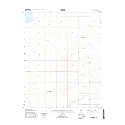
2016 Map of Bishop Ranch
USGS Topo · Published 2016About this map
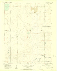
Bishop Ranch anchors this high plains landscape in Bent County, where the infrastructure of water management dictates the patterns of rural life. The southern portion of the sheet is dominated by the sweeping curve of the Fort Lyon Canal, a vital irrigation artery for this arid region. To the northwest, the Adobe Cr Reservoir serves as a significant hydrological marker, collecting surface water in a landscape defined by its grid-based ranching and agricultural divisions. The territory is strictly organized by a network of sectional roads, including Co RD VV, Co RD SS, and Co RD LL, which provide access to the vast grazing lands across T21S and T22S. This survey shows the enduring reliance on engineered waterways to sustain the livestock and agricultural operations characteristic of eastern Colorado.
Find a feature on this map
16 named features on this map. Tap any name to fly to it.
Don’t see what you’re looking for? This feature index may not catch every label — zoom into the map to look around manually.
Map Details
Editions of this 2016 Bishop Ranch Map
This is the sole edition of this map. No revisions or reprints were ever made.
Other maps of this area
1891 · Las Animas
USGS Topo · 1:125,000
1893 · Las Animas
USGS Topo · 1:125,000
1953 · Las Animas
USGS Topo · 1:24,000
1953 · Cornelia
USGS Topo · 1:24,000
1953 · Kreybill
USGS Topo · 1:24,000

1954 · Lamar
USGS Topo · 1:250,000
1955 · Tree Top Ranch
USGS Topo · 1:24,000
1955 · Mc Intosh Ranch
USGS Topo · 1:24,000
1955 · Bishop Ranch
USGS Topo · 1:24,000

1958 · Lamar
USGS Topo · 1:250,000