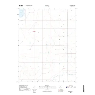
2019 Map of Bishop Ranch
USGS Topo · Published 2019About this map
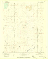
Bishop Ranch occupies a central position on this landscape in southeastern Colorado, representing the agricultural and ranching operations that define this portion of Bent County. The terrain is shaped by the presence of significant water management features, most notably the Adobe Creek Reservoir in the northwestern corner and the Fort Lyon Canal winding through the southern sections. These features indicate the critical role of irrigation in sustaining the rural economy of the high plains. The map reveals a structured grid of county roads, such as Co RD VV and Co RD 10, which provide the primary framework for movement between the isolated ranching outposts and water resources. The sparse distribution of named settlements emphasizes the low-density, pastoral nature of the region during this era.
Find a feature on this map
16 named features on this map. Tap any name to fly to it.
Don’t see what you’re looking for? This feature index may not catch every label — zoom into the map to look around manually.
Map Details
Editions of this 2019 Bishop Ranch Map
This is the sole edition of this map. No revisions or reprints were ever made.
Other maps of this area
1891 · Las Animas
USGS Topo · 1:125,000
1893 · Las Animas
USGS Topo · 1:125,000
1953 · Las Animas
USGS Topo · 1:24,000
1953 · Cornelia
USGS Topo · 1:24,000
1953 · Kreybill
USGS Topo · 1:24,000

1954 · Lamar
USGS Topo · 1:250,000
1955 · Tree Top Ranch
USGS Topo · 1:24,000
1955 · Mc Intosh Ranch
USGS Topo · 1:24,000
1955 · Bishop Ranch
USGS Topo · 1:24,000

1958 · Lamar
USGS Topo · 1:250,000