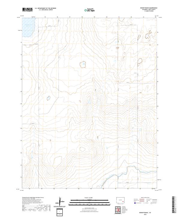
2022 Map of Bishop Ranch
USGS Topo · Published 2022About this map
Adobe Creek Reservoir dominates the northwestern corner of this landscape, serving as a critical water storage point in the high plains of Bent County. The terrain is defined by the sophisticated irrigation infrastructure required for agriculture in this arid region, most notably the Fort Lyon Canal and its accompanying Fort Lyon Canal Rd in the southeast. This 2022 survey illustrates the geometric precision of the Public Land Survey System, with the landscape divided into townships such as t21s r52w and t21s r51w. A network of county roads, including Co Rd 10 and Co Rd 15, follows these section lines, connecting dispersed ranching operations across the open plains. The map provides a clear record of modern rural infrastructure, where water rights and road access dictate the pattern of settlement and land use.
Find a feature on this map
16 named features on this map. Tap any name to fly to it.
Don’t see what you’re looking for? This feature index may not catch every label — zoom into the map to look around manually.
Map Details
Editions of this 2022 Bishop Ranch Map
This is the sole edition of this map. No revisions or reprints were ever made.
Other maps of this area

1891 · Las Animas
USGS Topo · 1:125,000

1893 · Las Animas
USGS Topo · 1:125,000

1953 · Las Animas
USGS Topo · 1:24,000

1953 · Cornelia
USGS Topo · 1:24,000

1953 · Kreybill
USGS Topo · 1:24,000

1954 · Lamar
USGS Topo · 1:250,000

1955 · Tree Top Ranch
USGS Topo · 1:24,000

1955 · Mc Intosh Ranch
USGS Topo · 1:24,000

1955 · Bishop Ranch
USGS Topo · 1:24,000

1958 · Lamar
USGS Topo · 1:250,000