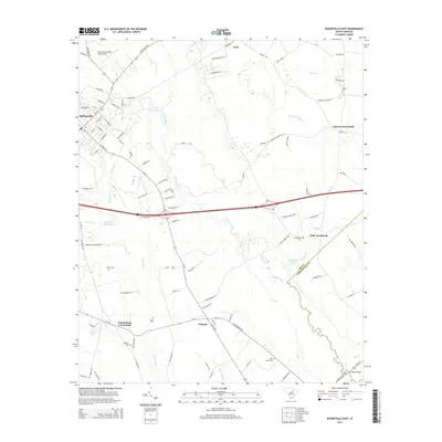
2014 Map of Bishopville East
USGS Topo · Published 2014About this map
The Lynches River and Black River systems define the low-lying agricultural landscape of eastern Lee County. This environment is marked by numerous drainage features such as Newman Swamp and Stony Run Br, which historically dictated the placement of rural settlements and transport corridors. Small communities like Wisacky, Alcot, and Cypress Crossroads are positioned along a web of local roads, often centered around family-named landmarks and rural burial grounds. Genealogists can identify several specific sites, including Marys Cem, Scotts Cem, and Coopers Cem, which anchor the map’s historical record of the area's local lineages.
Find a feature on this map
98 named features on this map. Tap any name to fly to it.
Don’t see what you’re looking for? This feature index may not catch every label — zoom into the map to look around manually.
Map Details
Editions of this 2014 Bishopville East Map
This is the sole edition of this map. No revisions or reprints were ever made.
Other maps of this area

1941 · Spartanburg
USGS Topo · 1:250,000

1953 · Spartanburg
USGS Topo · 1:250,000

1957 · Ashwood
USGS Topo · 1:62,500

1960 · Spartanburg
USGS Topo · 1:250,000

1963 · Spartanburg
USGS Topo · 1:250,000

1964 · Spartanburg
USGS Topo · 1:250,000

1968 · Kellytown
USGS Topo · 1:24,000
1968 · Hartsville South
USGS Topo · 1:24,000
1969 · Lamar
USGS Topo · 1:24,000
1969 · Bishopville East
USGS Topo · 1:24,000