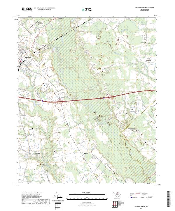
2024 Map of Bishopville East
USGS Topo · Published 2024About this map
Bishopville serves as the primary hub on this map, anchored by the Lee County Courthouse and bounded by the winding course of the Black River. The landscape transitions from the urban street grid of the county seat to the agrarian stretches of Lee County, where historical crossroads like Wisacky and McCutchens Crossroads mark the intersections of old country roads. The hydrology is dominated by the Lynches River and its various tributaries, including Stony Run Branch and Newman Swamp, which define the low-lying terrain. Genealogy researchers will find significant value in the numerous burial grounds documented, such as Saint Paul Church Graveyard and Emmanuel Community Church Graveyard. Evidence of early local industry and water management persists in features like English Millpond and Shaws Pond, while modern infrastructure is represented by the Lee County Airport-Butters Field and the corridor of I-20.
Find a feature on this map
111 named features on this map. Tap any name to fly to it.
Don’t see what you’re looking for? This feature index may not catch every label — zoom into the map to look around manually.
Map Details
Editions of this 2024 Bishopville East Map
This is the sole edition of this map. No revisions or reprints were ever made.
Other maps of this area

1941 · Spartanburg
USGS Topo · 1:250,000

1953 · Spartanburg
USGS Topo · 1:250,000

1957 · Ashwood
USGS Topo · 1:62,500

1960 · Spartanburg
USGS Topo · 1:250,000

1963 · Spartanburg
USGS Topo · 1:250,000

1964 · Spartanburg
USGS Topo · 1:250,000

1968 · Kellytown
USGS Topo · 1:24,000
1968 · Hartsville South
USGS Topo · 1:24,000
1969 · Lamar
USGS Topo · 1:24,000
1969 · Bishopville East
USGS Topo · 1:24,000