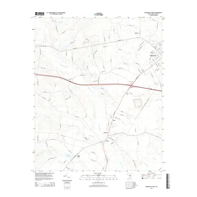
2014 Map of Bishopville West
USGS Topo · Published 2014About this map
Scape Ore Swamp dominates the central topography of this Lee County landscape, a winding drainage system that dictates the placement of early settlements and roads. To the east, the edge of Bishopville reveals a structured grid of residential streets like Baskin Ave and Baskin Avenue, while the rural western reaches are defined by smaller communities such as Manville, Carters Crossing, and Rose Hill. The distribution of family and community burial grounds, including the Bethlehem Cemeteries and Whilden Cem, provides a map of the area's genealogical roots.
Find a feature on this map
100 named features on this map. Tap any name to fly to it.
Don’t see what you’re looking for? This feature index may not catch every label — zoom into the map to look around manually.
Map Details
Editions of this 2014 Bishopville West Map
This is the sole edition of this map. No revisions or reprints were ever made.
Other maps of this area

1941 · Spartanburg
USGS Topo · 1:250,000

1953 · Spartanburg
USGS Topo · 1:250,000

1957 · Ashwood
USGS Topo · 1:62,500

1960 · Spartanburg
USGS Topo · 1:250,000

1963 · Spartanburg
USGS Topo · 1:250,000

1964 · Spartanburg
USGS Topo · 1:250,000

1968 · Kellytown
USGS Topo · 1:24,000
1969 · Bishopville East
USGS Topo · 1:24,000
1970 · Cassatt
USGS Topo · 1:24,000
1970 · Lucknow
USGS Topo · 1:24,000