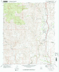
1969 Map of Black Butte
USGS Topo · Published 1973About this map
The Agua Fria River carves a deep path through this landscape, separating the high Bradshaw Mountains from the broad expanse of Williams Mesa. By the late 1960s, the area reflects a mix of traditional mining and newer leisure industries. Along the river's eastern banks, Black Canyon City and Rock Springs serve as key hubs of activity, while the Black Canyon Greyhound Park represents a distinct era of regional entertainment.
Find a feature on this map
36 named features on this map. Tap any name to fly to it.
Don’t see what you’re looking for? This feature index may not catch every label — zoom into the map to look around manually.
Map Details
Editions of this 1969 Black Butte Map
This is the sole edition of this map. No revisions or reprints were ever made.
Other maps of this area

1942 · Vicksburg
USGS Topo · 1:250,000

1954 · Phoenix
USGS Topo · 1:250,000

1957 · Phoenix
USGS Topo · 1:250,000

1958 · Phoenix
USGS Topo · 1:250,000

1960 · Phoenix
USGS Topo · 1:250,000

1961 · Vulture Mountains
USGS Topo · 1:62,500

1961 · Big Horn Mts
USGS Topo · 1:62,500

1962 · Belmont Mts
USGS Topo · 1:62,500
1962 · Aguila
USGS Topo · 1:62,500

1969 · Phoenix
USGS Topo · 1:250,000