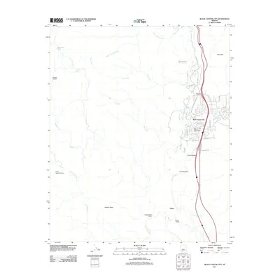
2011 Map of Black Canyon City
USGS Topo · Published 2011About this map
Black Canyon City sits as the primary settlement in this corridor of the Agua Fria River valley, shown here in the early twenty-first century. The map details a transition from the structured street grids of Black Canyon City and Rock Springs to the arid mesas and canyons that define the surrounding Yavapai County landscape. The transport corridor is a dominant feature, anchored by the Black Canyon Interchange and the Rock Springs Interchange, while local history is marked by the presence of Gillette to the south. Water management and terrain are central to the area's layout, with numerous drainage features like Soap Creek, Slate Creek, and Boulder Creek feeding toward the main river. Historical mining and ranching legacies are quietly preserved in names such as S Maggie Mine Rd and Shamrock Tank, alongside natural landmarks like Black Mesa and Horseshoe Bar.
Find a feature on this map
42 named features on this map. Tap any name to fly to it.
Don’t see what you’re looking for? This feature index may not catch every label — zoom into the map to look around manually.
Map Details
Editions of this 2011 Black Canyon City Map
This is the sole edition of this map. No revisions or reprints were ever made.
Other maps of this area

1887 · Prescott
USGS Topo · 1:250,000

1892 · Prescott
USGS Topo · 1:250,000

1903 · Bradshaw Mountains
USGS Topo · 1:125,000

1947 · Crown King
USGS Topo · 1:62,500

1947 · Bumblebee
USGS Topo · 1:62,500

1948 · Bumblebee
USGS Topo · 1:63,360

1948 · Crown King
USGS Topo · 1:63,360

1950 · Crown King
USGS Topo · 1:62,500

1950 · Bumblebee
USGS Topo · 1:62,500

1950 · Prescott
USGS Topo · 1:250,000