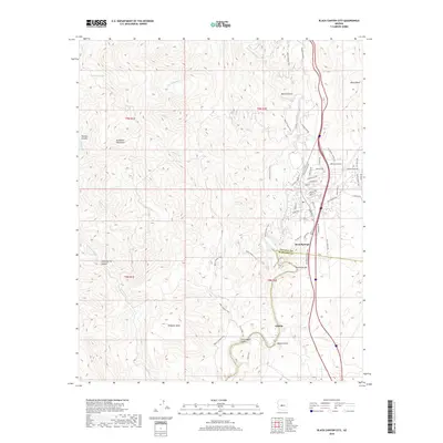
2018 Map of Black Canyon City
USGS Topo · Published 2018About this map
The Aqua Fria River cuts a deep path through this section of the Bradshaw Mountains, anchoring a landscape defined by sharp elevation changes and the historic settlements of Black Canyon and Rock Springs. This 2018 survey documents the intricate interface between Yavapai and Maricopa counties, where the high desert terrain of Williams Mesa and Black Mesa drops into the riparian corridor. The presence of Maggie Mine Rd and School House Rd hints at the area's development from mining roots into a residential and recreational hub. Movement through the canyon is traced by the Black Canyon Trail, which winds past Horseshoe Bar and the site of Gillette. The map provides a detailed view of the modern road network, including Scenic Loop and the E Frontage Rd, as they navigate the complex topography created by tributaries like Soap Cr and Little Squaw Cr.
Find a feature on this map
60 named features on this map. Tap any name to fly to it.
Don’t see what you’re looking for? This feature index may not catch every label — zoom into the map to look around manually.
Map Details
Editions of this 2018 Black Canyon City Map
This is the sole edition of this map. No revisions or reprints were ever made.
Other maps of this area

1887 · Prescott
USGS Topo · 1:250,000

1892 · Prescott
USGS Topo · 1:250,000

1903 · Bradshaw Mountains
USGS Topo · 1:125,000

1947 · Crown King
USGS Topo · 1:62,500

1947 · Bumblebee
USGS Topo · 1:62,500

1948 · Bumblebee
USGS Topo · 1:63,360

1948 · Crown King
USGS Topo · 1:63,360

1950 · Crown King
USGS Topo · 1:62,500

1950 · Bumblebee
USGS Topo · 1:62,500

1950 · Prescott
USGS Topo · 1:250,000