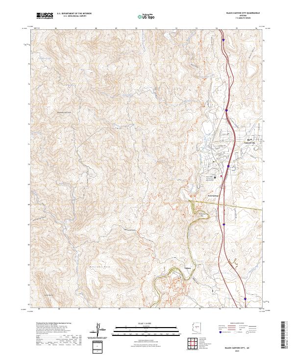
2023 Map of Black Canyon City
USGS Topo · Published 2023About this map
Black Canyon City and the historic waystation of Rock Springs anchor this portion of the high desert where the Agua Fria River cuts through the canyonlands. The landscape transitions from the rugged Bradshaw Mountains in the west toward the protected reaches of the Agua Fria National Monument and the prominent Black Mesa to the east. Along the river, the site of Gillette and the Horseshoe Bar illustrate the traditional importance of water access in this arid environment. The modern infrastructure of Interstate 17 follows the path of older routes like the Old Black Canyon Hwy, providing a clear view of how transportation has evolved through this geographic bottleneck. Local heritage is further marked by the Black Canyon City Municipal Memorial Park and various residential streets like E School Rd and Schoolhouse Rd that define the community core.
Find a feature on this map
65 named features on this map. Tap any name to fly to it.
Don’t see what you’re looking for? This feature index may not catch every label — zoom into the map to look around manually.
Map Details
Editions of this 2023 Black Canyon City Map
This is the sole edition of this map. No revisions or reprints were ever made.
Other maps of this area

1887 · Prescott
USGS Topo · 1:250,000

1892 · Prescott
USGS Topo · 1:250,000

1903 · Bradshaw Mountains
USGS Topo · 1:125,000

1947 · Crown King
USGS Topo · 1:62,500

1947 · Bumblebee
USGS Topo · 1:62,500

1948 · Bumblebee
USGS Topo · 1:63,360

1948 · Crown King
USGS Topo · 1:63,360

1950 · Crown King
USGS Topo · 1:62,500

1950 · Bumblebee
USGS Topo · 1:62,500

1950 · Prescott
USGS Topo · 1:250,000