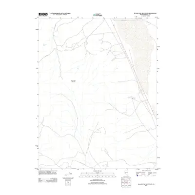
2011 Map of Black Dyke Mountain
USGS Topo · Published 2011About this map
Black Dyke Mountain stands as the central topographic landmark in this section of Mineral County, Nevada, providing a stark backdrop to the industrial and natural features of the high desert. Evidence of local industry is found at the New Boston Mill, while the presence of Farrington Spring highlights the critical importance of water sources in this arid environment. The landscape is interconnected by a network of thoroughfares, including the remote Garfield Flats Rd and the aptly named New York Cyn. These features together illustrate a region defined by its geological character and its history of resource processing and desert travel.
Find a feature on this map
7 named features on this map. Tap any name to fly to it.
Don’t see what you’re looking for? This feature index may not catch every label — zoom into the map to look around manually.
Map Details
Editions of this 2011 Black Dyke Mountain Map
This is the sole edition of this map. No revisions or reprints were ever made.
Other maps of this area

1909 · Hawthorne
USGS Topo · 1:250,000

1911 · Hawthorne
USGS Topo · 1:250,000

1915 · Hawthorne
USGS Topo · 1:250,000

1948 · Walker Lake
USGS Topo · 1:250,000

1957 · Walker Lake
USGS Topo · 1:250,000

1962 · Walker Lake
USGS Topo · 1:250,000

1964 · Walker Lake
USGS Topo · 1:250,000

1967 · Moho Mountain
USGS Topo · 1:24,000

1967 · Mina NW
USGS Topo · 1:24,000
1967 · Sodaville
USGS Topo · 1:24,000