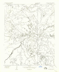
1955 Map of Black Falls 4 SE
USGS Topo · Published 1957About this map
Navajo Indian Reservation lands dominate this mid-century topographic record, showing a landscape defined by seasonal water systems and high desert relief. The primary drainage of Dinnebito Wash carves through the center of the sheet, supported by scattered human-made infrastructure like a Reservoir and several small Tank sites used for water management in an arid climate. In the southern portion of the quadrangle, the prominent rise of Newberry Mesa provides significant elevation changes, with the survey control point at VABM 4851 Dinne marking one of the higher summits. This preliminary edition, based on 1953 aerial photography, captures the network of unimproved roads and trails that connected these remote desert landmarks before more modern development reached this part of Coconino County.
Find a feature on this map
6 named features on this map. Tap any name to fly to it.
Don’t see what you’re looking for? This feature index may not catch every label — zoom into the map to look around manually.
Map Details
Editions of this 1955 Black Falls 4 SE Map
This is the sole edition of this map. No revisions or reprints were ever made.
Other maps of this area

1883 · Tusayan
USGS Topo · 1:250,000

1886 · Tusayan
USGS Topo · 1:250,000

1886 · San Francisco Mtns
USGS Topo · 1:250,000

1891 · San Francisco Mtns
USGS Topo · 1:250,000

1894 · San Francisco Mtns
USGS Topo · 1:250,000

1899 · San Francisco Mtns
USGS Topo · 1:250,000

1947 · Flagstaff
USGS Topo · 1:250,000

1954 · Flagstaff
USGS Topo · 1:250,000

1955 · Grand Falls NE
USGS Topo · 1:24,000

1955 · Black Falls 4 SW
USGS Topo · 1:24,000