
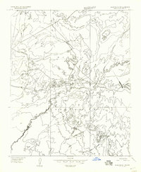
1955 Map of Black Falls 4 SW
USGS Topo · Published 1957About this map
The Navajo Indian Reservation landscape is defined by the sharp topographic shifts of Ward Terrace and the winding course of the Little Colorado River. This 1950s mapping project focuses on the arid expanses where the Desert floor meets complex geological formations, such as the high point at Color VABM 5041. The drainage patterns are clearly visible, particularly along the Dinnebito Wash as it cuts through the high plateau.
Find a feature on this map
7 named features on this map. Tap any name to fly to it.
Don’t see what you’re looking for? This feature index may not catch every label — zoom into the map to look around manually.
Map Details
Editions of this 1955 Black Falls 4 SW Map
This is the sole edition of this map. No revisions or reprints were ever made.
Other maps of this area

1886 · San Francisco Mtns
USGS Topo · 1:250,000

1891 · San Francisco Mtns
USGS Topo · 1:250,000

1894 · San Francisco Mtns
USGS Topo · 1:250,000

1899 · San Francisco Mtns
USGS Topo · 1:250,000

1947 · Flagstaff
USGS Topo · 1:250,000

1954 · Flagstaff
USGS Topo · 1:250,000

1955 · Grand Falls NE
USGS Topo · 1:24,000

1955 · Black Falls NE
USGS Topo · 1:24,000
1955 · Black Falls 4 SE
USGS Topo · 1:24,000

1958 · Flagstaff
USGS Topo · 1:250,000