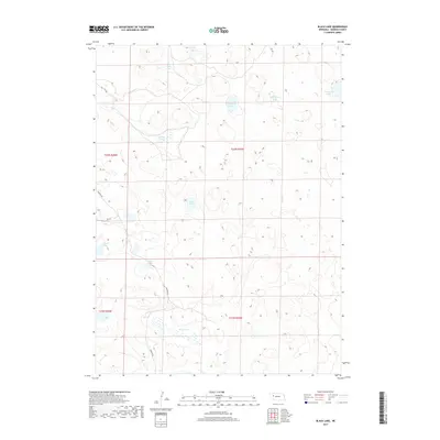
2017 Map of Black Lake
USGS Topo · Published 2017About this map
The Nebraska Sandhills in Garden County reveal a landscape defined by an intricate network of pocketed wetlands and interdunal lakes in this 2017 survey. Black Lake and Rockford Lake anchor a central corridor of water bodies that include Wild Horse Lake and Taylor Lake, illustrating the unique hydrography of the high plains. The terrain is largely defined by the Public Land Survey System divisions of T23N R43W and T22N R44W, where the absence of dense town sites highlights the area's rural, ranching-oriented character. Local connectivity is maintained by a sparse grid of unpaved routes such as Lakeside Rd and Rd 138, which navigate around features like Adams Lake and Mohall Lake. This map provides a clear record of the region's surface water distribution, essential for understanding land use and environmental shifts in this part of the Great Plains.
Find a feature on this map
18 named features on this map. Tap any name to fly to it.
Don’t see what you’re looking for? This feature index may not catch every label — zoom into the map to look around manually.
Map Details
Editions of this 2017 Black Lake Map
This is the sole edition of this map. No revisions or reprints were ever made.
Other maps of this area

1948 · Bingham
USGS Topo · 1:62,500

1948 · Lakeside
USGS Topo · 1:62,500

1949 · Mumper
USGS Topo · 1:62,500

1950 · Longfellow Lake
USGS Topo · 1:62,500

1950 · Lakeside
USGS Topo · 1:62,500

1950 · Bingham
USGS Topo · 1:62,500

1954 · Scottsbluff
USGS Topo · 1:250,000

1955 · Alliance
USGS Topo · 1:250,000

1957 · Alliance
USGS Topo · 1:250,000

1958 · Alliance
USGS Topo · 1:250,000