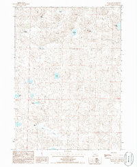
1986 Map of Black Lake
USGS Topo · Published 1986About this map
Half-Circle Ranch and Black Ranch anchor this landscape of the Nebraska Sandhills in the mid-1980s, illustrating the sparse ranching patterns typical of Garden County. The terrain is characterized by a high density of alkali and freshwater basins, including the sizable Black Lake in the southern portion and Rockford Lake near the center. Navigating this environment relied heavily on seasonal routes, as indicated by the numerous 4wd trails that connect isolated wells and cattle operations. The presence of named water bodies like Wild Horse Lake and Ross Lake highlights the critical importance of surface water in an area defined by its shifting sand dunes. This provisional map captures a snapshot of the region's geography before more modern developments, showing the exact placement of remote ranch buildings and land management points across township and range lines.
Find a feature on this map
17 named features on this map. Tap any name to fly to it.
Don’t see what you’re looking for? This feature index may not catch every label — zoom into the map to look around manually.
Map Details
Editions of this 1986 Black Lake Map
This is the sole edition of this map. No revisions or reprints were ever made.
Other maps of this area

1948 · Bingham
USGS Topo · 1:62,500

1948 · Lakeside
USGS Topo · 1:62,500

1949 · Mumper
USGS Topo · 1:62,500

1950 · Longfellow Lake
USGS Topo · 1:62,500

1950 · Lakeside
USGS Topo · 1:62,500

1950 · Bingham
USGS Topo · 1:62,500

1954 · Scottsbluff
USGS Topo · 1:250,000

1955 · Alliance
USGS Topo · 1:250,000

1957 · Alliance
USGS Topo · 1:250,000

1958 · Alliance
USGS Topo · 1:250,000