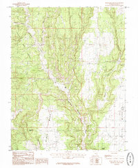
1985 Map of Black Mesa Butte
USGS Topo · Published 1985About this map
Cheese And Raisins, a distinctively named terrain feature, dominates the northwestern landscape of this mid-1980s Utah survey. The area is defined by the high, flat expanses of Black Mesa and White Mesa, which are carved by a network of drainage systems including Cottonwood Wash and Brushy Basin Wash. These deep incisions into the Colorado Plateau provide a clear picture of the region's geological complexity before modern environmental changes altered the surface water patterns. Evidence of human activity is sparse but notable, with scattered Prospect locations and a Mine Shaft indicating mineral exploration. Water sources, vital in this arid environment, are marked at Ruin Spring and Jakes Hole. The map also identifies the prominent landmark Black Mesa Butte, which serves as a navigational anchor for the surrounding canyons and draws.
Find a feature on this map
17 named features on this map. Tap any name to fly to it.
Don’t see what you’re looking for? This feature index may not catch every label — zoom into the map to look around manually.
Map Details
Editions of this 1985 Black Mesa Butte Map
This is the sole edition of this map. No revisions or reprints were ever made.
Other maps of this area

1886 · Abajo
USGS Topo · 1:250,000

1892 · Abajo
USGS Topo · 1:250,000

1893 · Abajo
USGS Topo · 1:250,000

1935 · Elk Ridge
USGS Topo · 1:96,000

1940 · Elk Ridge
USGS Topo · 1:125,000

1954 · Elk Ridge 4 NW
USGS Topo · 1:24,000

1956 · Cortez
USGS Topo · 1:250,000
1957 · Elk Ridge 4 NE
USGS Topo · 1:24,000

1957 · Elk Ridge 4 SE
USGS Topo · 1:24,000

1957 · Brushy Basin Wash
USGS Topo · 1:62,500