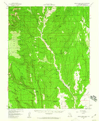
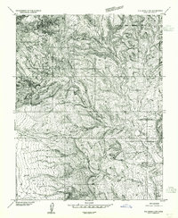
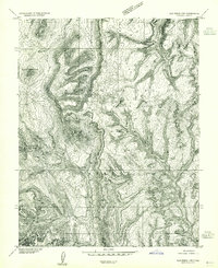
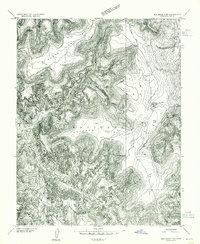
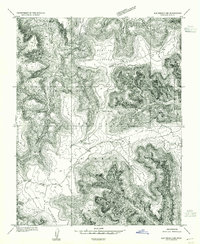
1957 Map of Brushy Basin Wash
USGS Topo · Published 1960About this map
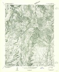
Comb Ridge bisects this mid-century landscape, a massive monocline that defines the transition between high mesas and the canyon floors of San Juan County. Surveyed during a period of uranium exploration and AEC involvement, the map documents a sparse but significant human presence. The Indian Village and isolated Perkins Ranch represent the modern inhabitants, while multiple Cliff Dwelling sites and Cliff Dwellings marked along the sandstone walls of Mule Canyon and Little Baullie Mesa record the ancient legacy of the area. A small Cemetery and a remote Landing Strip serve as markers of local infrastructure in the 1950s. The northern portion is dominated by the Manti La Sal National Forest, featuring landmarks like Mancos Jim Butte and the curiously named Hammond Cream Pots, illustrating the mix of ranching heritage and geologic curiosity in this corner of Utah.
Find a feature on this map
46 named features on this map. Tap any name to fly to it.
Don’t see what you’re looking for? This feature index may not catch every label — zoom into the map to look around manually.
Map Details
Editions of this 1957 Brushy Basin Wash Map
4 editions found
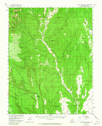
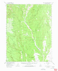
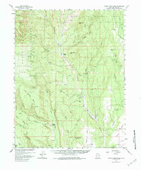
Other maps of this area

1886 · Abajo
USGS Topo · 1:250,000

1892 · Abajo
USGS Topo · 1:250,000

1893 · Abajo
USGS Topo · 1:250,000

1935 · Elk Ridge
USGS Topo · 1:96,000

1940 · Elk Ridge
USGS Topo · 1:125,000
1954 · Elk Ridge 4 NW
USGS Topo · 1:24,000
1954 · Elk Ridge 1 SW
USGS Topo · 1:24,000
1954 · Elk Ridge 2 SE
USGS Topo · 1:24,000
1954 · Elk Ridge 3 NE
USGS Topo · 1:24,000
1954 · Elk Ridge 1 SE
USGS Topo · 1:24,000