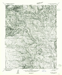
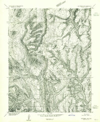
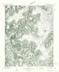
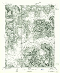
1954 Map of Elk Ridge 4 NW
USGS Topo · Published 1954About this map
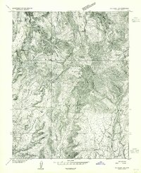
Indian Village and the Milk Ranch represent the primary points of human presence in this mid-century survey of San Juan County. The landscape is defined by the dramatic drainage systems of Hammond Canyon and Cottonwood Canyon, which carve through the high plateaus of the Manti-La Sal National Forest. Topographic details reveal several distinctive overlooks including Edwards Point, Whiskers Point, and East Point, while the striking geological feature of Comb Ridge emerges in the southeastern corner.
Find a feature on this map
17 named features on this map. Tap any name to fly to it.
Don’t see what you’re looking for? This feature index may not catch every label — zoom into the map to look around manually.
Map Details
Editions of this 1954 Elk Ridge 4 NW Map
This is the sole edition of this map. No revisions or reprints were ever made.
Other maps of this area

1886 · Abajo
USGS Topo · 1:250,000

1892 · Abajo
USGS Topo · 1:250,000

1893 · Abajo
USGS Topo · 1:250,000

1935 · Elk Ridge
USGS Topo · 1:96,000

1940 · Elk Ridge
USGS Topo · 1:125,000
1954 · Elk Ridge 1 SW
USGS Topo · 1:24,000
1954 · Elk Ridge 2 SE
USGS Topo · 1:24,000
1954 · Elk Ridge 3 NE
USGS Topo · 1:24,000
1954 · Elk Ridge 1 SE
USGS Topo · 1:24,000
1954 · Elk Ridge 3 SE
USGS Topo · 1:24,000