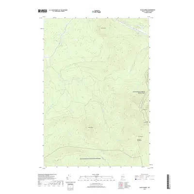
2018 Map of Black Nubble
USGS Topo · Published 2018About this map
Appalachian National Scenic Trail winds through the high ridges of Franklin County, marking the eastern boundary of this high-elevation terrain. This survey captures a landscape of extreme relief, dominated by the peaks of Crocker Mtn, South Crocker Mtn, and Mt Redington. The drainage patterns are defined by the headwaters of Nash Stream, its W Br Nash Stream, and Skunk Br, which carve deep valleys between the massifs.
Find a feature on this map
18 named features on this map. Tap any name to fly to it.
Don’t see what you’re looking for? This feature index may not catch every label — zoom into the map to look around manually.
Map Details
Editions of this 2018 Black Nubble Map
This is the sole edition of this map. No revisions or reprints were ever made.
Other maps of this area

1928 · Stratton
USGS Topo · 1:48,000

1929 · Phillips
USGS Topo · 1:48,000

1932 · Phillips
USGS Topo · 1:62,500

1932 · Stratton
USGS Topo · 1:62,500

1932 · Kennebago Lake
USGS Topo · 1:48,000

1933 · Rangeley
USGS Topo · 1:48,000

1935 · Kennebago Lake
USGS Topo · 1:62,500

1936 · Kennebago Lake
USGS Topo · 1:62,500

1939 · Rangeley
USGS Topo · 1:62,500

1949 · Jackman
USGS Topo · 1:250,000
Featured Places
- Carrabassett Valley, ME
- Coplin Plantation, ME
- Wyman Township, ME
- Mount Abram Township, ME
- Redington Township, ME