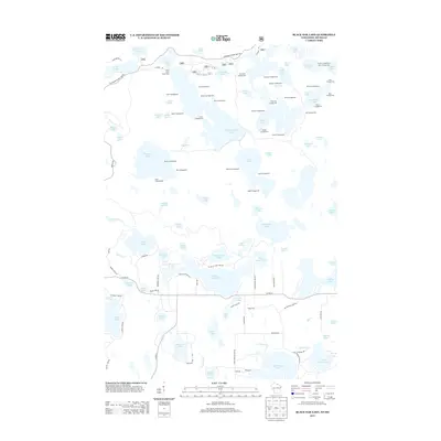
2013 Map of Black Oak Lake
USGS Topo · Published 2013About this map
Glacial lakes and dense forests dominate this 2013 survey of the Wisconsin-Michigan border country. The landscape is defined by an intricate network of waterways, including the large Black Oak Lake and Whitefish Lake, which are surrounded by dozens of smaller kettle ponds and drainage basins. A high concentration of named campsites, such as Porcupine Campground, Balsam Campground, and Raccoon Campground, suggests a region heavily managed for wilderness recreation and conservation.
Find a feature on this map
119 named features on this map. Tap any name to fly to it.
Don’t see what you’re looking for? This feature index may not catch every label — zoom into the map to look around manually.
Map Details
Editions of this 2013 Black Oak Lake Map
This is the sole edition of this map. No revisions or reprints were ever made.
Other maps of this area

1938 · Phelps
USGS Topo · 1:48,000

1946 · Star Lake
USGS Topo · 1:48,000

1950 · Phelps
USGS Topo · 1:48,000

1950 · Star Lake
USGS Topo · 1:48,000

1952 · Watersmeet
USGS Topo · 1:62,500

1952 · Thayer
USGS Topo · 1:62,500

1955 · Starlake
USGS Topo · 1:62,500

1956 · Phelps
USGS Topo · 1:62,500

1958 · Iron River
USGS Topo · 1:250,000

1960 · Iron River
USGS Topo · 1:250,000