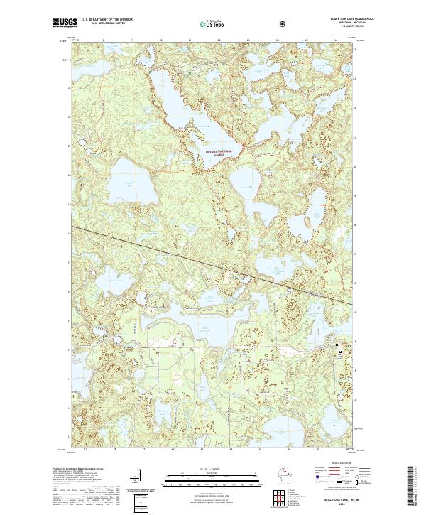
2022 Map of Black Oak Lake
USGS Topo · Published 2022About this map
Ottawa National Forest dominates this northern landscape, where the border between Michigan and Wisconsin cuts through a dense concentration of glacial lakes. The complex hydrography of the region is evident in the sprawling waters of Whitefish Lake and Black Oak Lake, which are interconnected by a network of local routes like W Black Oak Lake Rd and S Black Oak Lake Rd. This area reflects a long-established recreational and timber character, with numerous named trails such as the Whitefish Lake Bike Trl and Fisher Lake Trl winding between bodies of water like Glimmerglass Lake and Corey Lake.
Find a feature on this map
118 named features on this map. Tap any name to fly to it.
Don’t see what you’re looking for? This feature index may not catch every label — zoom into the map to look around manually.
Map Details
Editions of this 2022 Black Oak Lake Map
This is the sole edition of this map. No revisions or reprints were ever made.
Other maps of this area

1938 · Phelps
USGS Topo · 1:48,000

1946 · Star Lake
USGS Topo · 1:48,000

1950 · Phelps
USGS Topo · 1:48,000

1950 · Star Lake
USGS Topo · 1:48,000

1952 · Watersmeet
USGS Topo · 1:62,500

1952 · Thayer
USGS Topo · 1:62,500

1955 · Starlake
USGS Topo · 1:62,500

1956 · Phelps
USGS Topo · 1:62,500

1958 · Iron River
USGS Topo · 1:250,000

1960 · Iron River
USGS Topo · 1:250,000