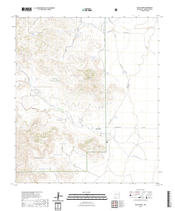
2023 Map of Black Point
USGS Topo · Published 2023About this map
Cloverdale sits as a primary point of reference in the high desert of Hidalgo County, where the southern reaches of the Coronado National Forest meet the international borderlands. The landscape is defined by the convergence of the Peloncillo Mountains and the Guadalupe Mountains, punctuated by prominent elevations such as Kilmer Peak and the volcanic-named Black Point. Water is the critical shaping force for settlement and ranching here, evidenced by the numerous catchment points like Black CCC Tank and Cowan Tank, along with the vital Cloverdale Spring. The ranching infrastructure is linked by a network of primitive roads and trails, including Battalion Rd and the Guadalupe Canyon Trl, which follow the natural contours of the drainages like Foster Draw. The presence of the Cloverdale Cem near the banks of Cloverdale Creek provides a localized record of the families who established themselves in this remote southwestern corner of New Mexico.
Find a feature on this map
40 named features on this map. Tap any name to fly to it.
Don’t see what you’re looking for? This feature index may not catch every label — zoom into the map to look around manually.
Map Details
Editions of this 2023 Black Point Map
This is the sole edition of this map. No revisions or reprints were ever made.
Other maps of this area

1917 · Chiricahua
USGS Topo · 1:125,000

1918 · Cienega Springs
USGS Topo · 1:62,500

1918 · Animas Peak
USGS Topo · 1:62,500

1919 · Perilla
USGS Topo · 1:125,000

1919 · Chiricahua
USGS Topo · 1:125,000

1920 · Animas Peak
USGS Topo · 1:62,500

1922 · McDonald
USGS Topo · 1:62,500

1940 · Apache
USGS Topo · 1:62,500

1955 · Douglas
USGS Topo · 1:250,000

1958 · Apache
USGS Topo · 1:62,500