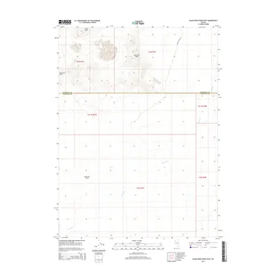
2014 Map of Black Rock Point East
USGS Topo · Published 2014About this map
Black Rock Desert dominates the southern half of this landscape, a vast expanse defined by its extreme flatness and seasonal drainage patterns. The ephemeral waters of the Quinn River meander across the playa, illustrating the delicate hydrology of the Great Basin where rivers often terminate in endorheic basins rather than reaching the sea. To the north, the terrain shifts abruptly as the Black Rock Range rises, anchored by prominent landmarks such as Rocky Peak and the geological namesake of the area, Black Rock Point. The map also captures the administrative boundary between Humboldt and Pershing counties, which cuts directly through the desert floor. Apart from the isolated Leonard Creek Rd in the northeast, the area remains largely devoid of modern development, preserving the remote character of this northwestern Nevada corridor.
Find a feature on this map
13 named features on this map. Tap any name to fly to it.
Don’t see what you’re looking for? This feature index may not catch every label — zoom into the map to look around manually.
Map Details
Editions of this 2014 Black Rock Point East Map
This is the sole edition of this map. No revisions or reprints were ever made.
Other maps of this area

1886 · Disaster
USGS Topo · 1:250,000

1886 · Granite Range
USGS Topo · 1:250,000

1889 · Long Valley
USGS Topo · 1:250,000

1893 · Disaster
USGS Topo · 1:250,000

1894 · Granite Range
USGS Topo · 1:250,000

1931 · Lovelock
USGS Topo · 1:250,000

1935 · Lovelock
USGS Topo · 1:250,000

1954 · Vya
USGS Topo · 1:250,000

1955 · Lovelock
USGS Topo · 1:250,000

1958 · Vya
USGS Topo · 1:250,000