
1955 Map of Lovelock
USGS Topo · Published 1963About this map
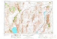
Pyramid Lake and the dry basin of Winnemucca Lake dominate the southwestern corner of this mid-century western Nevada landscape, where the Pyramid Lake Indian Reservation meets the vast reaches of the Black Rock Desert. The U S Naval Gunnery Range occupies several massive tracts of land, signaling the military's significant presence in the Great Basin during the Cold War era. The region's economy is clearly defined by its reliance on transport and extraction, with the Southern Pacific and Western Pacific railroads threading between mountain ranges to serve remote outposts like Gerlach and Jungo.
Find a feature on this map
106 named features on this map. Tap any name to fly to it.
Don’t see what you’re looking for? This feature index may not catch every label — zoom into the map to look around manually.
Map Details
Editions of this 1955 Lovelock Map
5 editions found
Other maps of this area

1882 · Paradise
USGS Topo · 1:250,000

1886 · Alturas
USGS Topo · 1:250,000

1886 · Honey Lake
USGS Topo · 1:250,000

1886 · Disaster
USGS Topo · 1:250,000

1886 · Granite Range
USGS Topo · 1:250,000

1889 · Long Valley
USGS Topo · 1:250,000

1890 · Wadsworth
USGS Topo · 1:125,000

1890 · Sierraville
USGS Topo · 1:125,000

1891 · Honey Lake
USGS Topo · 1:250,000

1891 · Reno
USGS Topo · 1:125,000