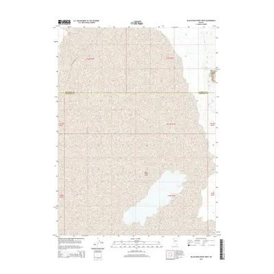
2015 Map of Black Rock Point West
USGS Topo · Published 2015About this map
Black Rock Desert dominates this northern Nevada landscape, revealing the expansive alkali flats and complex hydrography of the Great Basin. The survey highlights critical water sources in an otherwise arid expanse, most notably the Black Rock Springs situated near the prominent geologic landmark of Black Rock Point. The map provides a detailed view of the regional boundary between Humboldt and Pershing counties, illustrating how geopolitical lines were drawn across the desert floor. Remote transportation is represented by Soldier Meadow Rd, which skirts the edge of the playa. This 2015 edition captures the interplay of natural springs and desert terrain, essential data for those studying the environmental history and historical routes through this portion of the western United States.
Find a feature on this map
13 named features on this map. Tap any name to fly to it.
Don’t see what you’re looking for? This feature index may not catch every label — zoom into the map to look around manually.
Map Details
Editions of this 2015 Black Rock Point West Map
This is the sole edition of this map. No revisions or reprints were ever made.
Other maps of this area

1886 · Disaster
USGS Topo · 1:250,000

1886 · Granite Range
USGS Topo · 1:250,000

1889 · Long Valley
USGS Topo · 1:250,000

1893 · Disaster
USGS Topo · 1:250,000

1894 · Granite Range
USGS Topo · 1:250,000

1931 · Lovelock
USGS Topo · 1:250,000

1935 · Lovelock
USGS Topo · 1:250,000

1954 · Vya
USGS Topo · 1:250,000

1955 · Lovelock
USGS Topo · 1:250,000

1958 · Vya
USGS Topo · 1:250,000