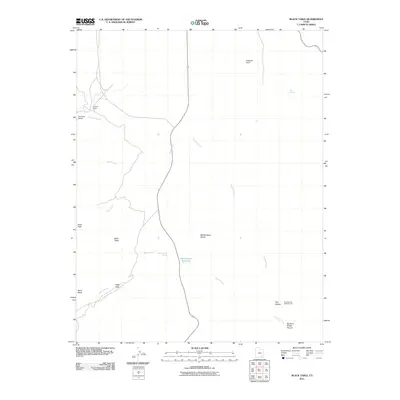
2011 Map of Black Table
USGS Topo · Published 2011About this map
Trachyte Ranch sits at the head of a complex drainage system where Trachyte Creek and its tributaries carve through the desert floor. This 2011 survey captures a landscape defined by water scarcity and relief, centered on the Maidenwater Reservoir and the essential Maidenwater Spring. The geography is dictated by prominent landforms such as the Black Table and Black Mesa, which rise above the sandy floor of Maidenwater Sands. The presence of the Hog Springs Campground near the convergence of Trail Canyon and Big Horn Sheep Canyon indicates the area's role as a point of access for travelers and outdoorsmen in this corner of Garfield County. The drainage patterns of Speck Creek and Black Creek highlight how geological features like Farmers Knob and the Hogs Back funnel seasonal runoff through this arid environment.
Find a feature on this map
18 named features on this map. Tap any name to fly to it.
Don’t see what you’re looking for? This feature index may not catch every label — zoom into the map to look around manually.
Map Details
Editions of this 2011 Black Table Map
This is the sole edition of this map. No revisions or reprints were ever made.
Other maps of this area

1885 · San Rafael
USGS Topo · 1:250,000

1886 · Henry Mountains
USGS Topo · 1:250,000

1892 · Henry Mountains
USGS Topo · 1:250,000

1952 · Mt Pennell 1 SW
USGS Topo · 1:24,000

1952 · Orange Cliffs 3 SW
USGS Topo · 1:24,000

1952 · Mount Ellen 4 SW
USGS Topo · 1:24,000

1952 · Mt Pennell 1 NE
USGS Topo · 1:24,000

1952 · Mt Hillers
USGS Topo · 1:62,500

1952 · Mt Pennell 1 SE
USGS Topo · 1:24,000

1952 · Mt Pennell 1 NW
USGS Topo · 1:24,000