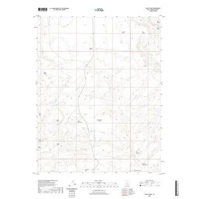
2020 Map of Black Table
USGS Topo · Published 2020About this map
The eastern foothills of the Henry Mountains dominate this 2020 landscape in Garfield County, defined by a complex network of high desert drainage and sharp topographical relief. Water is the primary architect here, evidenced by the winding path of Trachyte Cr and the collection of vital sources such as Maidenwater Spring and Hog Spring. This modern survey reveals a largely unpopulated region where infrastructure is limited to state routes 95 and 276, leaving the focus on prominent geologic features like the Black Table and the distinctively shaped Cocks Comb. The presence of the Maidenwater Reservoir and the nearby Maidenwater Sands highlights the importance of moisture management in this arid environment, while the names of canyons like Big Horn Sheep Canyon and Butler Canyon suggest the local wildlife and pioneers who navigated these corridors long before modern mapping.
Find a feature on this map
26 named features on this map. Tap any name to fly to it.
Don’t see what you’re looking for? This feature index may not catch every label — zoom into the map to look around manually.
Map Details
Editions of this 2020 Black Table Map
This is the sole edition of this map. No revisions or reprints were ever made.
Other maps of this area

1885 · San Rafael
USGS Topo · 1:250,000

1886 · Henry Mountains
USGS Topo · 1:250,000

1892 · Henry Mountains
USGS Topo · 1:250,000

1952 · Mt Pennell 1 SW
USGS Topo · 1:24,000

1952 · Orange Cliffs 3 SW
USGS Topo · 1:24,000

1952 · Mount Ellen 4 SW
USGS Topo · 1:24,000

1952 · Mt Pennell 1 NE
USGS Topo · 1:24,000

1952 · Mt Hillers
USGS Topo · 1:62,500

1952 · Mt Pennell 1 SE
USGS Topo · 1:24,000

1952 · Mt Pennell 1 NW
USGS Topo · 1:24,000