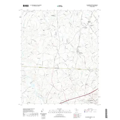
2020 Map of Blacksburg North
USGS Topo · Published 2020About this map
The Broad River and its tributary, the First Broad River, dominate this landscape straddling the state line between Cleveland County, North Carolina, and Cherokee County, South Carolina. Distinctive river features such as Styce Shoals and Gaston Shoals illustrate the natural rocky descent of the Piedmont terrain. Small communities and rural junctions like Patterson Springs, Earl, and Blacksburg anchor the region's settlement pattern, connected by a network of local roads including Sulphur Springs Rd and Blacksburg Rd.
Find a feature on this map
195 named features on this map. Tap any name to fly to it.
Don’t see what you’re looking for? This feature index may not catch every label — zoom into the map to look around manually.
Map Details
Editions of this 2020 Blacksburg North Map
This is the sole edition of this map. No revisions or reprints were ever made.
Other maps of this area

1906 · Kings Mountain
USGS Topo · 1:62,500

1908 · Kings Mountain
USGS Topo · 1:62,500

1909 · Gaffney
USGS Topo · 1:62,500

1909 · Lincolnton
USGS Topo · 1:62,500

1911 · Lincolnton
USGS Topo · 1:62,500

1950 · Shelby
USGS Topo · 1:62,500

1953 · Charlotte
USGS Topo · 1:250,000

1954 · Charlotte
USGS Topo · 1:250,000

1960 · Charlotte
USGS Topo · 1:250,000

1962 · Charlotte
USGS Topo · 1:250,000