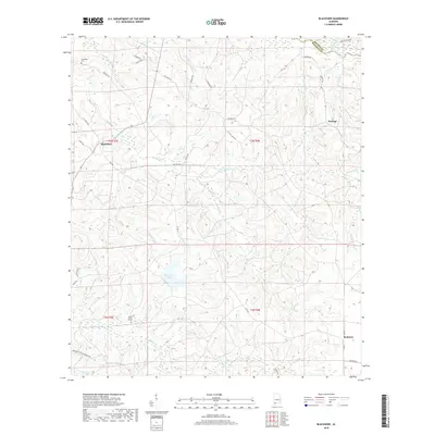
2018 Map of Blacksher
USGS Topo · Published 2018About this map
Blacksher and Serange anchor the northern landscape of this Baldwin County territory, where the terrain is defined by a dense network of creek branches and timber-related road networks. The influence of the forestry industry is evident in the presence of the Container Corp of America Rd, which cuts through the southwestern corner near Beard Cr. Central to the drainage of the area is the winding path of Turkey Creek, which flows toward the expansive Patterson Lake. Smaller settlements like Redtown are situated in the southeast, connected by a web of local routes such as Co Rd 61 and Dean Ln. For genealogists, the map identifies localized landmarks including Dixie Church and its adjacent Dixie Church Cem, as well as the Steadham Cem near the northwestern boundary. The northern edge highlights the Monroe County and Baldwin County line near the Little River.
Find a feature on this map
52 named features on this map. Tap any name to fly to it.
Don’t see what you’re looking for? This feature index may not catch every label — zoom into the map to look around manually.
Map Details
Editions of this 2018 Blacksher Map
This is the sole edition of this map. No revisions or reprints were ever made.
Other maps of this area

1942 · Perdido
USGS Topo · 1:62,500

1943 · Choctaw Bluff
USGS Topo · 1:62,500

1943 · Tensaw
USGS Topo · 1:62,500

1944 · Tensaw
USGS Topo · 1:62,500

1944 · Perdido
USGS Topo · 1:62,500

1946 · Choctaw Bluff
USGS Topo · 1:62,500

1953 · Andalusia
USGS Topo · 1:250,000

1957 · Andalusia
USGS Topo · 1:250,000

1972 · Chrysler
USGS Topo · 1:24,000

1972 · Uriah West
USGS Topo · 1:24,000