
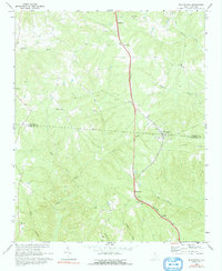
1968 Map of Blackstock
USGS Topo · Published 1973About this map
The Southern railroad line serves as the primary spine of development through this rural landscape on the border of Chester Co and Fairfield Co. The rail corridor links the small communities of Blackstock, Woodward, and Cornwell, anchoring the region's transport network amidst a complex web of watercourses. The drainage of the Little River and Big Wateree Creek dominates the topography, carving through the hills and providing the natural boundaries for early land tracts. Numerous small congregations and burial grounds dot the countryside, including Armenia Ch, Bethlehem Ch, and Antioch Ch, many of which are situated at high points or road junctions. The dense concentration of family-named landmarks and rural churches provides a detailed window into the mid-century social geography of South Carolina's Piedmont region, where small-scale farming and religious life centered around these modest rural hubs.
Find a feature on this map
30 named features on this map. Tap any name to fly to it.
Don’t see what you’re looking for? This feature index may not catch every label — zoom into the map to look around manually.
Map Details
Editions of this 1968 Blackstock Map
2 editions found
Other maps of this area

1904 · Columbia
USGS Topo · 1:125,000

1941 · Spartanburg
USGS Topo · 1:250,000

1953 · Spartanburg
USGS Topo · 1:250,000

1960 · Spartanburg
USGS Topo · 1:250,000

1963 · Spartanburg
USGS Topo · 1:250,000

1964 · Spartanburg
USGS Topo · 1:250,000

1969 · Lebanon
USGS Topo · 1:24,000
1969 · Salem Crossroads
USGS Topo · 1:24,000
1969 · Winnsboro
USGS Topo · 1:24,000
1969 · Stover
USGS Topo · 1:24,000