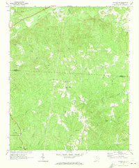
1969 Map of Carlisle SE
USGS Topo · Published 1973About this map
Feasterville serves as the primary focal point in this 1969 topographical study, situated at the southern edge of a landscape defined by the drainage basins of the Sandy River and Little Sandy River. The area is notably dense with rural religious sites, revealing a significant social geography centered on congregational life. Landmarks such as Sweet Hope Ch, Piney Grove Ch, and New Hope Ch are distributed throughout the countryside, often accompanied by family or church burial grounds like Sweet Hope Cem.
Find a feature on this map
31 named features on this map. Tap any name to fly to it.
Don’t see what you’re looking for? This feature index may not catch every label — zoom into the map to look around manually.
Map Details
Editions of this 1969 Carlisle SE Map
This is the sole edition of this map. No revisions or reprints were ever made.
Other maps of this area

1904 · Columbia
USGS Topo · 1:125,000

1941 · Spartanburg
USGS Topo · 1:250,000

1953 · Spartanburg
USGS Topo · 1:250,000

1960 · Spartanburg
USGS Topo · 1:250,000

1963 · Spartanburg
USGS Topo · 1:250,000

1964 · Spartanburg
USGS Topo · 1:250,000

1968 · Blackstock
USGS Topo · 1:24,000

1969 · Lebanon
USGS Topo · 1:24,000

1969 · Blair
USGS Topo · 1:24,000
1969 · Salem Crossroads
USGS Topo · 1:24,000