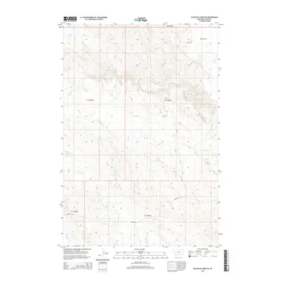
2014 Map of Blacktail Creek SE
USGS Topo · Published 2014About this map
Beaver Flats dominates the northeastern corner of this corner of Carter County, characterizing a high-plains landscape defined by its intricate drainage networks. The area is etched by numerous watercourses, including the westward-flowing Blacktail Cr and the complex branching of Spring Cr and S Spring Cr. These seasonal and perennial streams have carved the terrain into a dense series of ridges and draws, reflecting the slow erosion of the Montana prairie. Transportation in this section of the county is limited to a handful of thoroughfares, notably Powderville Rd and Beaver Flats Rd, which follow the natural contours of the land. The mapping of township and range lines, such as t1n r56e and t1s r56e, underscores the organized division of this expansive rangeland into the Public Land Survey System.
Find a feature on this map
13 named features on this map. Tap any name to fly to it.
Don’t see what you’re looking for? This feature index may not catch every label — zoom into the map to look around manually.
Map Details
Editions of this 2014 Blacktail Creek SE Map
This is the sole edition of this map. No revisions or reprints were ever made.
Other maps of this area

1954 · Ekalaka
USGS Topo · 1:250,000

1956 · Ekalaka
USGS Topo · 1:250,000

1958 · Ekalaka
USGS Topo · 1:250,000

1965 · Ekalaka
USGS Topo · 1:250,000

1979 · Blacktail Creek NW
USGS Topo · 1:24,000

1979 · Blacktail Creek SE
USGS Topo · 1:24,000

1979 · Board Corral Creek
USGS Topo · 1:24,000

1979 · Blacktail Creek SW
USGS Topo · 1:24,000

1979 · Beaver Flats South
USGS Topo · 1:24,000

1979 · Chalk Buttes
USGS Topo · 1:24,000