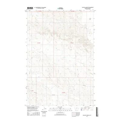
2017 Map of Blacktail Creek SE
USGS Topo · Published 2017About this map
Beaver Flats and a network of seasonal drainages define this portion of Carter County, Montana. The landscape is marked by the branching paths of Blacktail Cr, Alkali Cr, and Spring Cr, which carve through the high plains terrain. This 2017 survey shows a region largely defined by the Public Land Survey System grid, with township and range lines like t1n r56e and t2n r55e providing the primary structure for land division. The presence of Powderville Rd in the southern half of the map indicates a vital local transportation artery, connecting this sparsely populated area to larger regional networks. The map also traces the headwaters of S Spring Cr and Whitetail Cr, showing the intricate natural hydrology that persists in this corner of the state.
Find a feature on this map
13 named features on this map. Tap any name to fly to it.
Don’t see what you’re looking for? This feature index may not catch every label — zoom into the map to look around manually.
Map Details
Editions of this 2017 Blacktail Creek SE Map
This is the sole edition of this map. No revisions or reprints were ever made.
Other maps of this area

1954 · Ekalaka
USGS Topo · 1:250,000

1956 · Ekalaka
USGS Topo · 1:250,000

1958 · Ekalaka
USGS Topo · 1:250,000

1965 · Ekalaka
USGS Topo · 1:250,000

1979 · Blacktail Creek NW
USGS Topo · 1:24,000

1979 · Blacktail Creek SE
USGS Topo · 1:24,000

1979 · Board Corral Creek
USGS Topo · 1:24,000

1979 · Blacktail Creek SW
USGS Topo · 1:24,000

1979 · Beaver Flats South
USGS Topo · 1:24,000

1979 · Chalk Buttes
USGS Topo · 1:24,000