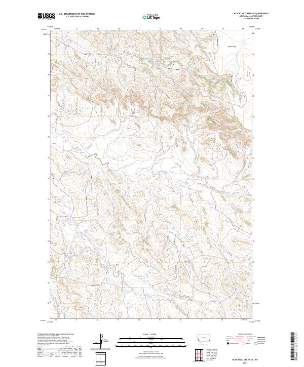
2024 Map of Blacktail Creek SE
USGS Topo · Published 2024About this map
Blacktail Creek and its many seasonal tributaries define this corner of Carter County, where the landscape is shaped by the drainage patterns of the northern plains. This topographic study reveals a terrain of subtle elevation changes, punctuated by the wide expanse of Beaver Flats in the northeast. The map illustrates the sparsely populated nature of the region, where infrastructure is limited to essential connectors like Powderville Rd. Water is the primary geographic anchor, with the winding paths of Spring Creek, South Spring Creek, and Whitetail Creek etching into the prairie. These watercourses remain vital landmarks for navigating the township and range system, which organizes the vast open sections of eastern Montana.
Find a feature on this map
13 named features on this map. Tap any name to fly to it.
Don’t see what you’re looking for? This feature index may not catch every label — zoom into the map to look around manually.
Map Details
Editions of this 2024 Blacktail Creek SE Map
This is the sole edition of this map. No revisions or reprints were ever made.
Other maps of this area

1954 · Ekalaka
USGS Topo · 1:250,000

1956 · Ekalaka
USGS Topo · 1:250,000

1958 · Ekalaka
USGS Topo · 1:250,000

1965 · Ekalaka
USGS Topo · 1:250,000

1979 · Blacktail Creek NW
USGS Topo · 1:24,000

1979 · Blacktail Creek SE
USGS Topo · 1:24,000

1979 · Board Corral Creek
USGS Topo · 1:24,000

1979 · Blacktail Creek SW
USGS Topo · 1:24,000

1979 · Beaver Flats South
USGS Topo · 1:24,000

1979 · Chalk Buttes
USGS Topo · 1:24,000