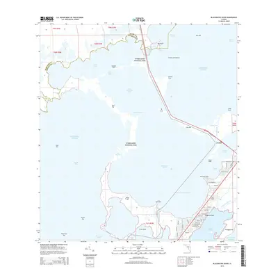
2015 Map of Blackwater Sound
USGS Topo · Published 2015About this map
Jewfish and Anglers Park sit at the critical land-and-water junction where the Upper Keys meet the mainland marshes. This survey details the complex network of sounds, passes, and human engineering that defines the northern entry to Key Largo. The Overseas Hwy serves as the primary spine of the landscape, crossing Jewfish Creek to connect the island chain with the mainland across Cross Key.
Find a feature on this map
74 named features on this map. Tap any name to fly to it.
Don’t see what you’re looking for? This feature index may not catch every label — zoom into the map to look around manually.
Map Details
Editions of this 2015 Blackwater Sound Map
This is the sole edition of this map. No revisions or reprints were ever made.
Other maps of this area

1947 · Garden Cove
USGS Topo · 1:24,000

1947 · Rock Harbor
USGS Topo · 1:24,000

1947 · Blackwater Sound
USGS Topo · 1:24,000

1949 · Blackwater Sound
USGS Topo · 1:24,000

1949 · Rock Harbor
USGS Topo · 1:24,000

1949 · Garden Cove
USGS Topo · 1:24,000

1949 · Card Sound
USGS Topo · 1:24,000

1950 · Glades
USGS Topo · 1:24,000

1956 · Card Sound
USGS Topo · 1:24,000

1956 · Glades
USGS Topo · 1:24,000