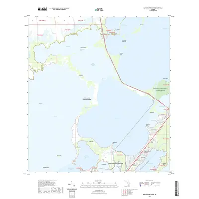
2021 Map of Blackwater Sound
USGS Topo · Published 2021About this map
Everglades National Park and the Crocodile Lake National Wildlife Refuge dominate this aquatic landscape where the southern tip of mainland Florida meets the upper Keys. The map details the intricate network of sounds and bays, including Little Blackwater Sound and Tarpon Basin, linked by the Intracoastal Waterway. This environment is a hub for recreational and transit routes, featuring both the Florida Keys Overseas Heritage Trl and the Florida Circumnavigational Paddling Trl.
Find a feature on this map
69 named features on this map. Tap any name to fly to it.
Don’t see what you’re looking for? This feature index may not catch every label — zoom into the map to look around manually.
Map Details
Editions of this 2021 Blackwater Sound Map
This is the sole edition of this map. No revisions or reprints were ever made.
Other maps of this area

1947 · Garden Cove
USGS Topo · 1:24,000

1947 · Rock Harbor
USGS Topo · 1:24,000

1947 · Blackwater Sound
USGS Topo · 1:24,000

1949 · Blackwater Sound
USGS Topo · 1:24,000

1949 · Rock Harbor
USGS Topo · 1:24,000

1949 · Garden Cove
USGS Topo · 1:24,000

1949 · Card Sound
USGS Topo · 1:24,000

1950 · Glades
USGS Topo · 1:24,000

1956 · Card Sound
USGS Topo · 1:24,000

1956 · Glades
USGS Topo · 1:24,000